Day 13 (Prince Rupert, BC to Ketchikan, AK)

Sunrise at Pillsbury Cove, near Prince Rupert, BC

Sunday, June 20, 2021 Distance: 95 miles Hours: 8 Cumulative distance since Everett, WA: 799 miles

Les’ Log Notes

We awoke at 4:00am to listen to the latest weather forecasts and reports. Every wave height indicator was “2 feet or less” or “1 meter or less”. The Central Dixon Entrance Buoy showed 1.3 feet, as low as I’ve seen it in a while. Winds were forecast for light and variable as they shift toward the northwest later today. We were moving away from our anchorage in Pillsbury Cove shortly before 5:00 and took our time following the Venn Passage out to Chatham Sound. The passage wasn’t bad – it was near low tide, and we never saw less than 13 feet. We took the north route around Tugwell Island, which some guides imply should be run at or near high tide, and we saw no less than 20 feet through that section.

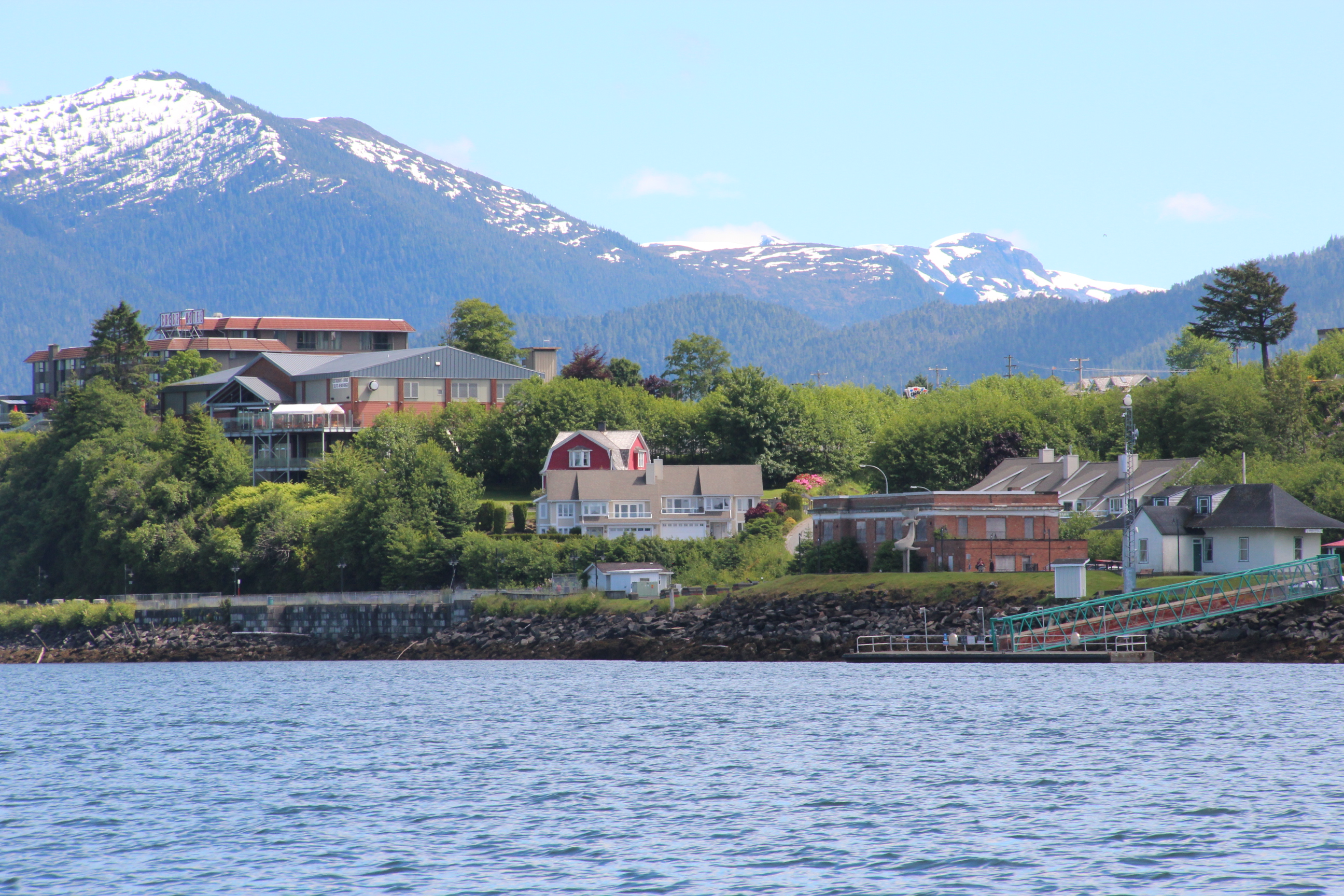
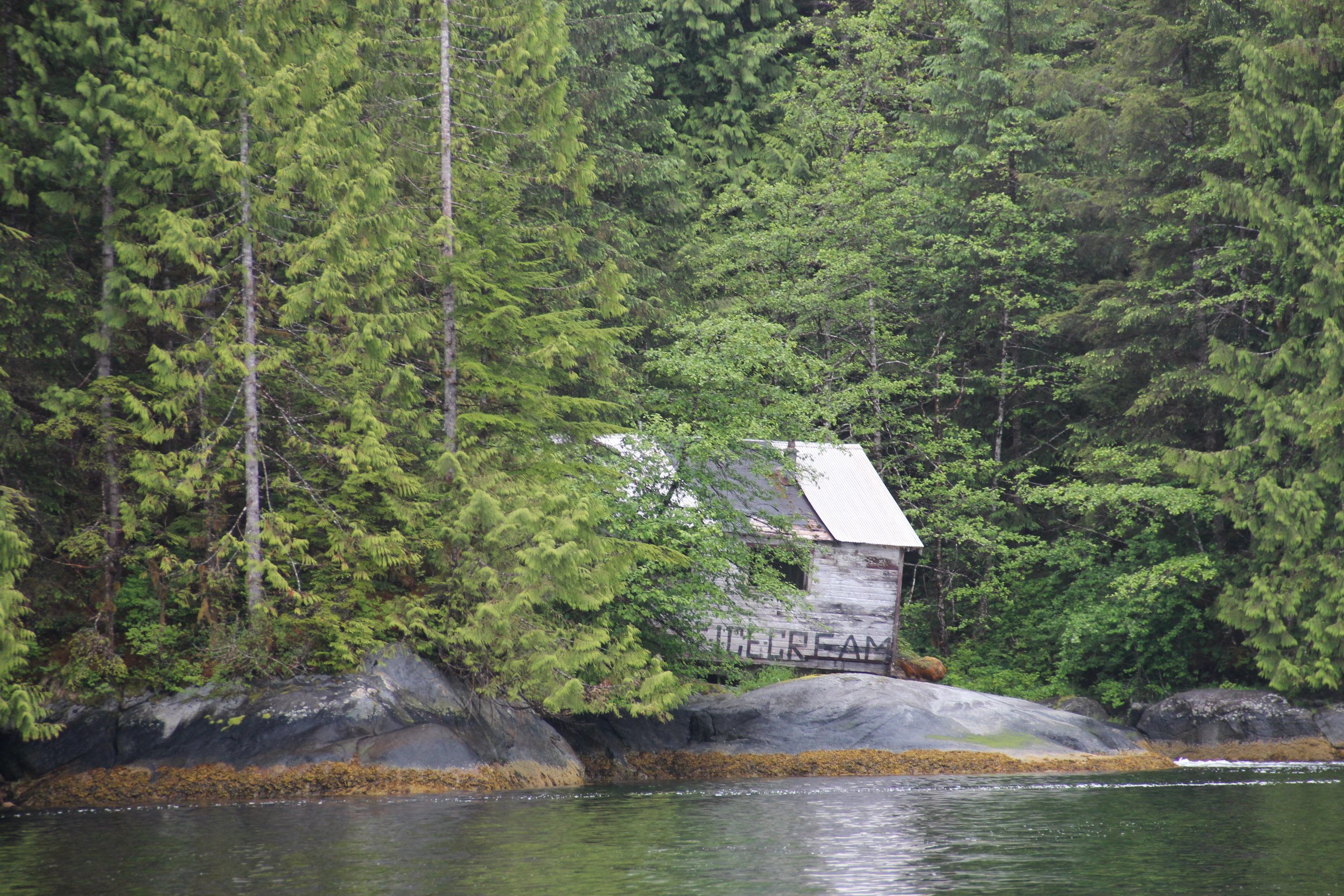
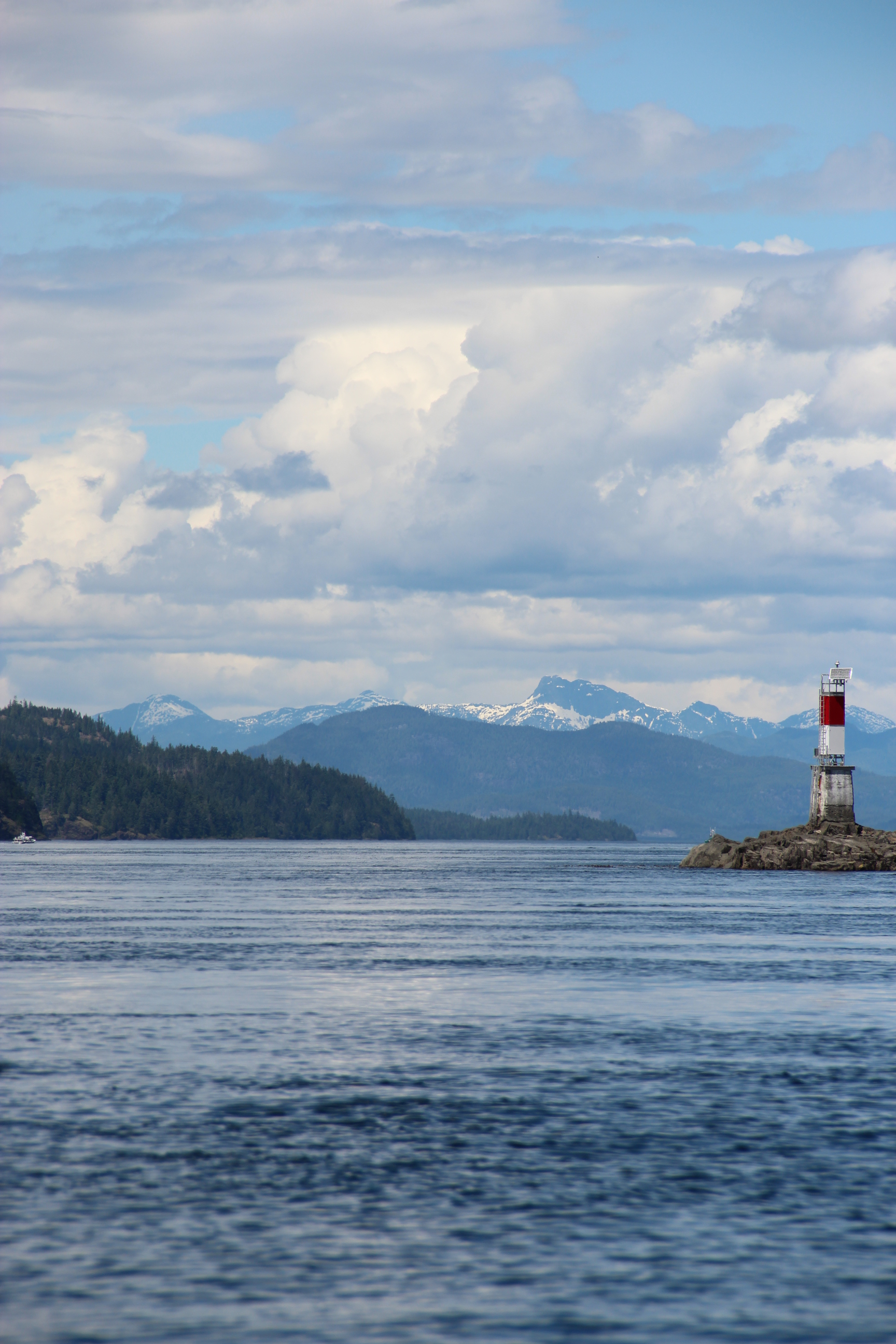
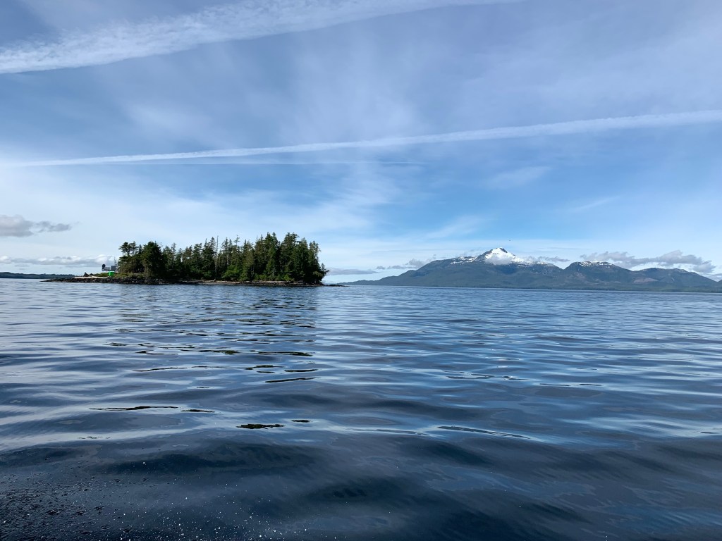
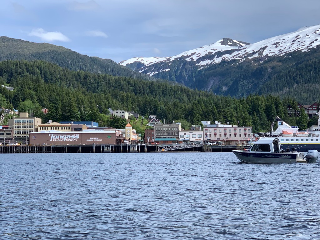
 Chatham Sound proved to be very smooth. We picked up increasing chop as we approached Dundas and Green Islands, but that subsided north of Dundas, where we experienced smooth swells with long periods.  We maintained 15-17mph throughout the crossing, and arrived in Ketchikan by 11:00am Alaska time. We stopped for gas on the way into the harbor and were assigned a slip in Bar Harbor South basin. We noted something was amiss when we arrived in Ketchikan… it was sunny and clear! I am told this issue will be resolved within the next day. (The average annual precipitation in Ketchikan is 141 inches, more than three times Seattle’s average annual precipitation.

After 9 days since leaving Roche Harbor and not being able to walk farther than the length of a fuel dock, we were in dire need of real showers and clean laundry. With those priorities taken care of, we had a nice meal at the local Mexican food restaurant.  It’s both satisfying and relieving to have completed this section of our trip. We’re now free to divert to places as we choose, and to travel as short a distance as we want each day.

It looks as if there’s a nasty storm coming in Wednesday and Thursday, so we will likely stay put until it passes.

Trip Summary for Everett to Ketchikan

Total (statute)* miles 799

Total days: 12

Days from Roche Harbor to Ketchikan: 9

Gas used: 269 gallons

Cumulative mpg: 2.97

Our mileage stats are in statute miles, as that’s how the chart plotters are configured. We’ve always had them set that way, since nearly all of our previous cruising has been on inland lakes and rivers, where distances are charted in statute, rather than nautical miles.

Kel’s Musings

Smooth cruising as we cross over into Alaskan waters

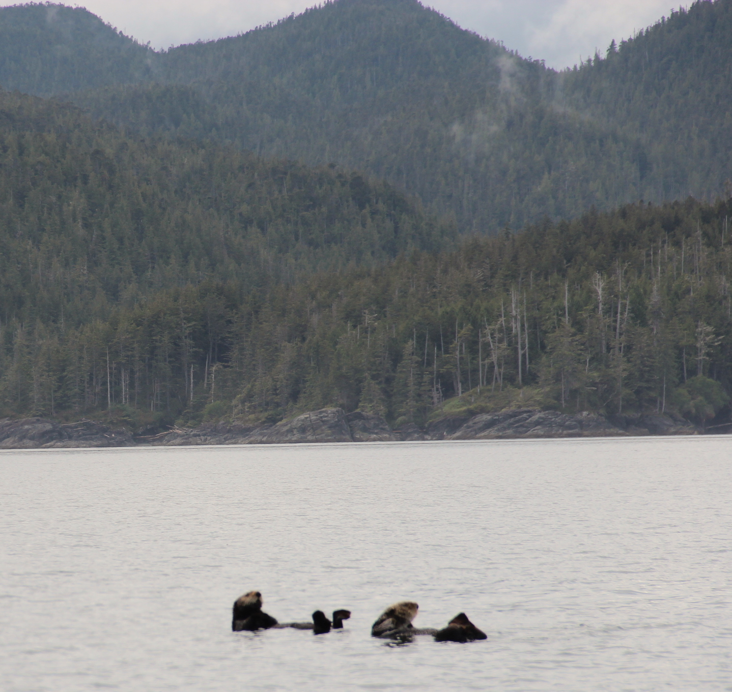
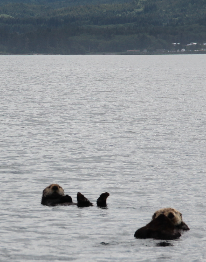
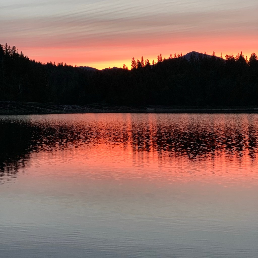
Yesterday, we woke to a pinkish-orange sunrise, silhouetting the pine covered landscape on the bay, where had anchored for our last time in Canadian waters for awhile. As Les mentioned smooth seas and sunshine led our way to Ketchikan, Alaska. I saw “my” seal pop its head out along the way, as if to say, “many joys await you.” I call it my seal, because, a harbor seal greeted us at the boat ramp in Everett, Washington, and I’ve seen a single seal at almost each inlet or bay that we moored/anchored in along the way. A friend passed along this symbolic meaning of the seal: ” . . . humor, ease of movement, good fortune, playfulness and joyful disposition. The seal is a reminder to enjoy life.” Very fitting for our journey.

We were greeted by a friendly attendant at the gas dock, and she asked about our journey. It fun to share my excitement of the budding summer adventures ahead of us. She said the sunshine was unusual, and that it had been “hot” on Saturday, in the 70s with no breeze. I smiled to myself knowing that family in Missouri and Arizona have hit highs in the 100s this past week. It’s all perspective, right?

Our passage from Washington to Alaska was one of the smoothest transits that could be expected. We really had one day of chop and the rest was pleasant puttering along the scenic waterways or cruising along the challenging, more open water at a comfortable speed to avoid getting caught in lumpy waters in late afternoons. We routinely woke at 4am and went to bed at 8:30pm after 8-12 hour days traveling on the water. So now that we’re at our destination, the pace is changing. We can sleep in. We don’t have to get anywhere and if the weather gets “snotty,” we can hunker down in our cabin and surf the internet or read a book or take a nap.

Coming into Ketchikan harbor was the end of this portion of the remote nature settings, and back into the hustle and bustle of an active port. Just before leaving the gas dock, the wakes of passing boats rocked our boat quite aggressively; Les was catching his balance inside and I was holding tight to the ropes I had loosened. (We were getting ready to leave the dock, when the wake took us by surprise. That experience reminded me that as boaters, we can’t let our guard down, even when we’re at our destination. We needed to be alert all the way to the marina.) I was a little shook up, and forgot that coming into an unknown situation is always a bit more stressful, than the excitement of arriving. We still had to call into the harbormaster to get a slip assignment, a water runway for seaplanes had to be avoided, and then we had to navigate into a unfamiliar marina to find our spot. The first spot suggested for us, was tightly packed in (we would have needed to do the equivalent of parallel parking to get into a space. We called the harbormaster again. He assigned us another spot, near where boats were off loading their catch of the day. We managed to get tied off without bumping into other boats. I find getting into a slip and putting the boat on and off the trailer very stressful. So once we were settled, I blew off a little steam by taking a nap. And Les went to the marina office. When he got back, we realized the slip we were assigned didn’t have hook-up for shore power. Ugh! We batted solutions around, and then just decided to wait for a bit. Once we were a little more settled, we called the harbormaster again and asked if we could get a slip with power. Thankfully we only had to move over one dock and not go down to the other end of the harbor.

Downtown Ketchikan, AK

Consider it a sheer gift, friends, when tests and challenges come at you from all sides. You know that under pressure, your faith-life is forced into the open and shows its true colors. So don’t try to get out of anything prematurely. Let it do its work so you become mature and well-developed, not deficient in any way. (James 1:2-4 The Message)

Day 12 (Baker Inlet to Prince Rupert) June 19, 2021

Words by Les and Kel Rohlf Photos by Kel Rohlf

View coming into Prince Rupert Harbor after the shipping docks and before the marinas

Baker Inlet to Prince Rupert Distance: 46 miles Hours: 6.2 Saturday, June 19, 2021

Les’ Log Notes

A gentle rain serenaded us for most of the night, but stopped by the time we woke up. With a little over 40 miles to travel today, we didn’t need to hurry. The flood tide was in full force at 6:00am, and I wanted to wait until closer to slack to transit Watts Narrows on the way out. We left at 7:45; we had some current to overcome on the way out, but less than when we arrived yesterday. For the first hour Grenville Channel was choppy, likely because the wind opposite the still-incoming tide.

After entering the Arthur Passage along the west side of Kennedy Island, the ride smoothed and we had a nice ride the rest of the way to Prince Rupert. We noticed an interesting barge chain leaving Prince Rupert today. One tug was pulling a barge with a large 2-story building that looked like it could be a motel. The other tug with it was towing two barges, each with smaller buildings. Towed behind the two smaller buildings were about a dozen center-console fishing boats. Can anyone explain what this is? I assume it’s something like a mobile fish camp being pre-positioned for the season.

We arrived in Prince Rupert by 1:00pm, quickly refilled gas and water, and anchored in Pillsbury Cove across from the harbor, where we have decent cell connectivity. A fairly open anchorage and a little breezy this afternoon, but will make a good starting point for our planned run to Ketchikan tomorrow. As of now the weather still looks favorable for tomorrow, after which the stronger northwesterly winds pick up for the next few days.

A note for the C-Brat readers: since Kel and I (Les) combine the content of these posts with her blog, I will regularly make comments to explain concepts to non-boaters. Please don’t consider these as providing instruction to the C-Brat audience. Since we acquired Intuition 11 years ago, everything I’ve learned about C-Dories and most of what I’ve learned about prudent seamanship (save those learned from my errors) have come from this site. We are incredibly indebted to everyone who generously shares their store of knowledge and expertise; your information from prior adventures, instruction, and encouragement have enabled us on this journey.

Musings from Kel

On this twelfth night of our voyage from entering British Columbia waters at Sidney to anchoring for our final time in Canada near Prince Rupert, I am overwhelmed. Overwhelmed and pleased in ways beyond describing. The scenery begs to be captured in photographs, descriptive language or artistry, but I am mostly awed into silence. Les will point out another sight along the way, and I pause before jumping from my perch to snap a photo with my phone or digital camera. A strange part of me doesn’t want to get worn out by the beauty, especially since I have been told there are even more magnificent things to see ahead.

Before leaving on this adventure, we tried to prepare ourselves for various challenges, but I wasn’t prepared for the grandeur we have witnessed, and thankfully we have learned over the past few years to enjoy the process and not run too far ahead in our imaginations of all the what ifs.

The Intuition is our retreat, our remote island escape, and my idea of tiny living. Things are simpler, yet not always. Like Les mentioned, water pumps fail and we have to clean up the mess. We still fume under our breath and get frustrated and disappointed, even when there’s a mountain towering over our heads, a few seagulls roosting on a log for the night and an eagle perched on a tree just off the bow of our boat. We have learned to ride through the frustrations, just like we work with the tides or “surf” over the immense wake of the BC ferry, which passed us and created four foot rollers that we rode with glee and trepidation.

At first, I didn’t want to help clean up the floor, where water leaked under our layers of dry deck and waterproof mat that run the length of our boat cabin. But I finally pitched in, and when our moods had softened, I thought to myself, well now the floor is clean. We plan to do a thorough cleaning of the cabin when we stop in Ketchikan for a few days to regroup, and restock the boat for the next phase of our expedition.

The pace of transiting Canadian waters has been heightened by our desire to get to our ultimate destination. We hope to enjoy a leisurely pace on the way back to savor the beauty of this passage.

So for now we will soak up all the internet while we can, and get to bed early to be ready for our early start tomorrow. Living on the boat for twelve days without contact with the terra firma has been easier than I expected, but I’m ready to do some walking around in Ketchikan this coming week.

God’s glory is on tour in the skies, God-craft on exhibit across the horizon. (Psalm 19:1 The Message)

Days 10-11 Shearwater to Baker Inlet (June 17-18, 2021)

Words by Les Rohlf Photos by Kel Rohlf

Les’ Log Notes

Shearwater to Khutze Inlet Miles: 80 Hours: 8.7 Thursday, June 17, 2021

Khutze Inlet

We luxuriated by fixing breakfast before departing the harbor at Shearwater, and started cruising at 5:45. The next section of the Inside Passage that’s open to the ocean is a relatively short crossing of Milbank Sound.  We hit the sound at 14 knots at 7:00. There were some pronounced swells and sections of chop. As we turned west and northwest, the swells hit us on the beam and made the ride busier. The swells and chop continued until we were well into Finlayson Channel. I’m thankful we didn’t make the run later in the day. It’s also scary how debris and large logs can disappear in the swells, especially given how low we sit to the water.

We passed a few fishing boats in Milbank Sound, then they passed us again once we slowed down in Tolmie Channel north of Klemtu. It started raining in earnest in Tolmie Channel and continued except for short periods through the remainder of the day. We arrived at our planned anchorage in Khutze Inlet at 2:45. Wow, what a beautiful setting (I’m sure this will become an overused description) – steep mountains on both sides, a snowcapped peak at the head of the inlet, and a waterfall running from the mountaintop to the water just across the inlet from our anchorage.

Waterfalls at Khutze Inlet

We dropped the anchor in a little nook in 50 feet of water about a mile inside the entrance. The two other larger cruisers who checked in after us in Sidney pulled in an hour after us and anchored a little farther into the inlet.  Despite the rain, we grilled chicken for dinner. The produce and meat we got from the IGA in Port McNeill two days ago has been excellent. They get a shipment only once a week, and our delivery was “late” in the week, so we have been quite pleased.

Khutze Inlet to Baker Inlet Miles: 83 Hours: 12.2 Friday, June 18, 2021

Baker Inlet

We struggled to get up early, but left the anchorage about 5:45 and made breakfast once underway. We had very smooth water all day, so slow cruised and enjoyed the scenery. While I enjoy eating up miles at speed, cruising at slower speeds make it easier to note and avoid logs and other debris in the water that could ruin one’s day.

We saw our first whale of the journey in McKay Reach just before entering Wright Sound. We saw the spout in the distance, then it dove right after. We had a few short moments of cell service as we passed south of Hartley Bay, and I dutifully made my ArriveCAN “daily report from quarantine”.

Midway through the Grenville Channel, we met BC Ferries Northern Adventure heading southbound. People pay good money for the thrill ride we got crossing her wake.

Waked by a BC ferry in Grenville Channel

We decided to spend the night in Baker Inlet, which is a beautiful and remote body of water separated from Grenville Channel by Watts Narrows. Waggoner Cruising Guide indicated the narrows could probably be transited with current (i.e. not during slack). We were midway through the flood tide when we passed through the windy, quarter-mile narrows. There was a little sporty rapids as the narrows flushed us into Baker Inlet, but no other situation that compromised directional control.

Kel enjoyed the stillness of Baker Inlet…hoping to spy a bear on the shore, instead she was entertained by seagulls on a log, some unidentifiable water critter (beaver or otter?) and the majesty of the mountains and an eagle perched in a pine tree watching over Intuition.

Tonight was shower night. Unfortunately, the shower sump failed midway through the process, resulting in a few gallons of water under the cabin step and on the cabin floor (Argh!!). Water draining from the shower passes though a hose under the cabin step, which leads to a sump box and pump under the cabinet on the opposite side of the boat. As water fills the box, a float switch triggers the pump to expel the water from the side of the boat – at least that’s the way it’s supposed to work. Something to troubleshoot when we have a spare day in a marina.

Deep calls to deep
in the roar of your waterfalls;
all your waves and breakers
have swept over me. (Psalm 42:7 NIV)

Collections

Words, Photos and Art by Kel Rohlf

Butedale (old Cannery Building)

The last few days, we’ve had intermittent cell service, thus the pile up of posts.

Les keeps a log separately from me, and I appreciate his perspective on each day’s journey. I also keep track of the time we leave, how many miles, and how many hours on the water, by conferring with him, and then scribbling notes in a small notebook. I am a collector of things: ideas, memories, words, photos, packaging from various things, vintage items, art supplies, etc.


I thought today I would share some of my “collections” from the journey so far. Sometimes my collections are in list form, other times a collage or even small poems in the tradition of haiku.


Let’s start with some lists that I’ve collected along the way:

Boat Names
No Regrets
Coda
Sudden Inspiration
Ocean Fresh
Ocean Defiant
Strumpet
Perpetuity
Curiosity
UnderDog
Danger Mouse
Lady Janet
Kurioso
Tequila
Oceanic

Weather Phrases
Flood tide
Neap tide
Ebb tide
Slack tide
Swells
When it’s rainy and windy the weather is “snotty”
When the water has rougher waves, we say it’s “lumpy” or “choppy”
Sometimes we’re “bucking” the tide, other times we are “riding” it in
Once Les said, “The waves are confused.” I said, “Huh?” He replied it’s when two channels meet and it’s harder to read the direction of the current.”

Things I Do on the Boat
Sometimes drive
Often make meals and do the dishes (which I enjoy more on the boat than at home)
Rearrange things to make them easier to stow and access
Read a book or map, when it’s not lumpy
Word Search Puzzles
Write in my journal or use my art supplies
Knit
Take photos
Talk to myself
One time, I mumbled to myself “It’s normal to talk to myself.” Les replied, “Huh?” I started laughing, and said “I should quote myself on that one: ‘It’s normal to talk to myself.’”

Here’s a couple art pages I made along the way:

A couple poems inspired by the road trip portion of the trip:

Rusted Reminiscence

Abandoned parking
lot or self-salvaged heap
for posterity sake?

(or prosperity stake?)

Stake your claim; take your
time to rummage through the lot—
rusty parts for free.

Remains that recall
their better days long gone,
but someone keeps them.

Drawn in more often
than not by a rusted scene,
will I salvage a story?

Nature Haiku

Two kinds of beauty
Clouds and mountains both
Scuplted out of air and earth

Tides and Currents

Words by Les Rohlf Photos by Kel Rohlf

South Entrance to Seymour Narrows

One of the new-to-us considerations for our cruise through the Inside Passage in British Columbia and Alaska is the high tidal extremes. The difference between high and low tides is much greater than what we’ve experienced during travels in Florida. In Juneau, for instance, during last week’s new moon, the difference between high and low tides was over 18 feet.

As all that water moves into (floods) and out of (ebbs) the inside passage fjords and channels on a twice-daily basis, strong currents can be created, especially where the flow of water is constricted by a narrower channel.

Narrows can see currents of over 10 mph. Furthermore, underwater obstacles create waves and whirlpools as they interrupt the flow of this fast-moving water. Swirling, fast currents make boat handling a chore at best and very dangerous at worst.

Internet Rabbit-hole: Google “Ripple Rock Explosion” for an account of how one such obstacle was removed.

Planning considerations for trips like this include:

Transiting narrows and rapids as close to slack water as possible – slack is the very short time between when one tidal cycle ends and the next begins. “High slack” occurs just as the flood tide finishes and the ebb tide starts. “Low slack” describes the point at which the ebb tide is finishing and the flood tide begins. We arrived a Seymour Narrows well ahead of low slack at a time when the current through the narrows would have provided an eight knot “push”, which would have been dicey for our smaller boat. We waited for the current to slow down a little before slack (about 3 knots of current) to ensure we completed the mile-long narrows before encountering the “headwind” of the incoming flood.

Moving in the same direction as the tidal flow – you can get a little boost of speed and use less fuel by moving in the direction of the tidal currents during that part of the day. Correspondingly, moving against the strongest time of tidal flow can decrease speed and/or increase fuel usage.

Winds blowing against tidal flow create waves, which can hinder passage in certain areas. When checking weather forecasts and planning for a specific day’s travel, the times of flood and ebb tides, along with wind direction and intensity, will determine whether safe transit of an area is practical.

Lots of planning considerations that aren’t needed with running down the muddy Mississippi.

Sea Otters in Galeta Channel outside of Port Hardy
Going with the FLOW

Whatsoever the Lord pleased, that did He in heaven and on earth, in the seas and in all deep places. (Psalm 135:6 KJV)