Lund, BC to Everett, WA (September 7-10)

Words by Les and Kel Rohlf

Photos by Kel Rohlf (unless otherwise indicated)

Our happy little boat back at Port of Everett marina

Les’ Notes

Tuesday, September 7, 2021

Lund to Pilot Bay

Miles: 86

Hours: 7.3

We left Lund late this morning after adding some fuel and spending the last of our Canadian cash at the store. I added enough gas to get to Friday Harbor; I’ll add enough cheaper gas there to finish the final 70 or so miles to Everett.

Having heard about the nice sandy beaches at Savary Island just a few miles southeast of Lund, we motored around it on our way out. We decided not to stop after rounding the western-most end of the island, seeing only rocky shoreline on the south side, and realizing we had passed the sandy beaches on the island’s north.

Tribune Bay beach (view from bow of the boat)

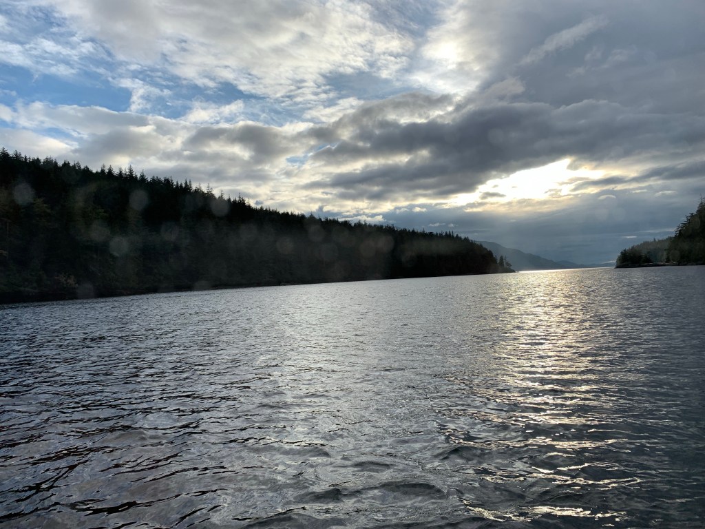
We continued on to Tribune Bay at the south end of Hornby Island. There’s a nice sandy beach and park that are quite popular. A number of boats were anchored in the bay. I had thought about anchoring in Tribune Bay for the night until the latest forecast indicated winds would shift to the southeast overnight. We anchored for an hour to enjoy the sunshine and warm weather (75 degrees F) then continued southeast in amazingly calm seas.

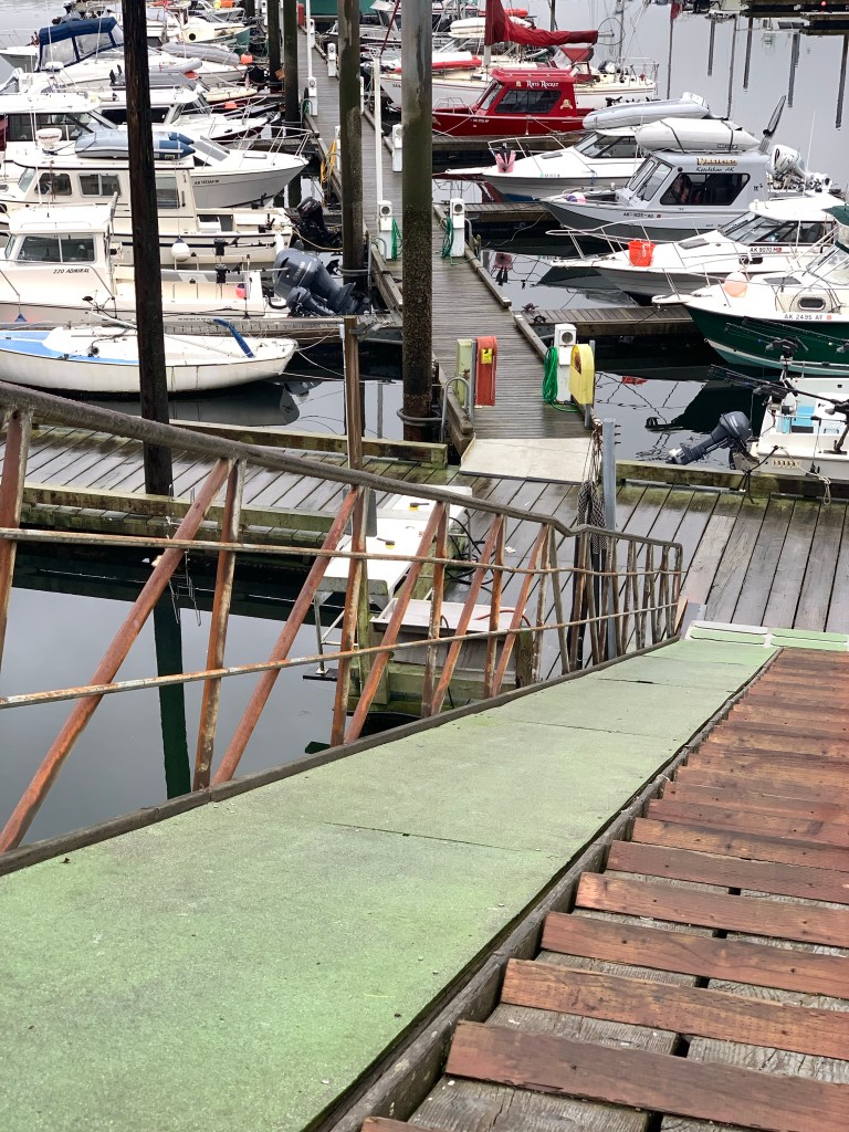
My latest plan for the day was to spend the night at Northwest Bay. With the calm seas this afternoon and brisk winds forecast for early tomorrow, we decided to keep going. Waves became bigger and messier the closer we got to Nanaimo, forcing us to slow down. We made it to Pilot Bay at the north end of Gabriola Island at 6:30 pm, as we had missed the window late this afternoon at Dodd Narrows. This anchorage puts us just a few miles from Dodd Narrows and limits our open-water exposure should winds be strong in the morning.

Wednesday, September 8, 2021

Pilot Bay (Photo Credit: Les Rohlf)

Pilot Bay to James Bay

Miles: 36

Hours: 5.2

Pilot Bay was pretty bouncy all night. It’s a nice bay with cute homes and cottages lining the shore and a park at its head. It’s open to the east and not very long, so swells from Strait of Georgia and wakes from the BC Ferries and tows that use the nearby channel can reach the bay. The wind held the bow to the south, with the swells entering from the east and hitting us on the beam. It was rolly enough that we didn’t try to cook breakfast, but relaxed and took care of a few other chores.

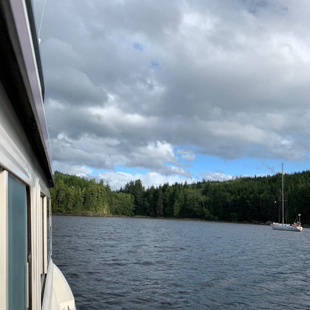
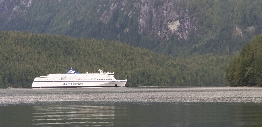
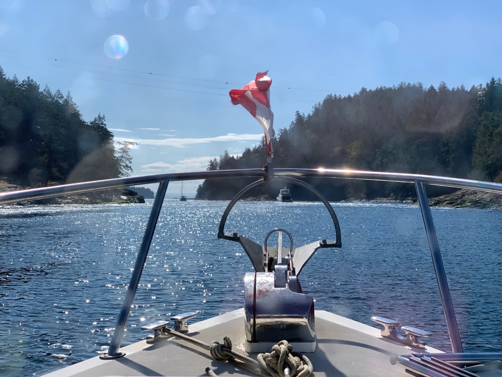
After I disengaged a small crab who had attached himself to the chain, we pulled the anchor and started toward Dodd Narrows shortly after 10:00 am, with a slack and turn to flood forecast for 11:42 am. We had rain showers overnight, but the skies began to clear as we were leaving. By the time we approached the narrows at 11:15am, there was a train of ten boats starting the southbound passage. It was very orderly; the largest cruiser started through, and everyone else followed expeditiously, so that all the southbound boats had passed through during the last of the ebb flow several minutes before the flood started. Another half dozen or so boats were waiting to pass north as we finished the passage, which was still flowing south with force, but without a lot of turbulence.

Entering Dodd Narrows

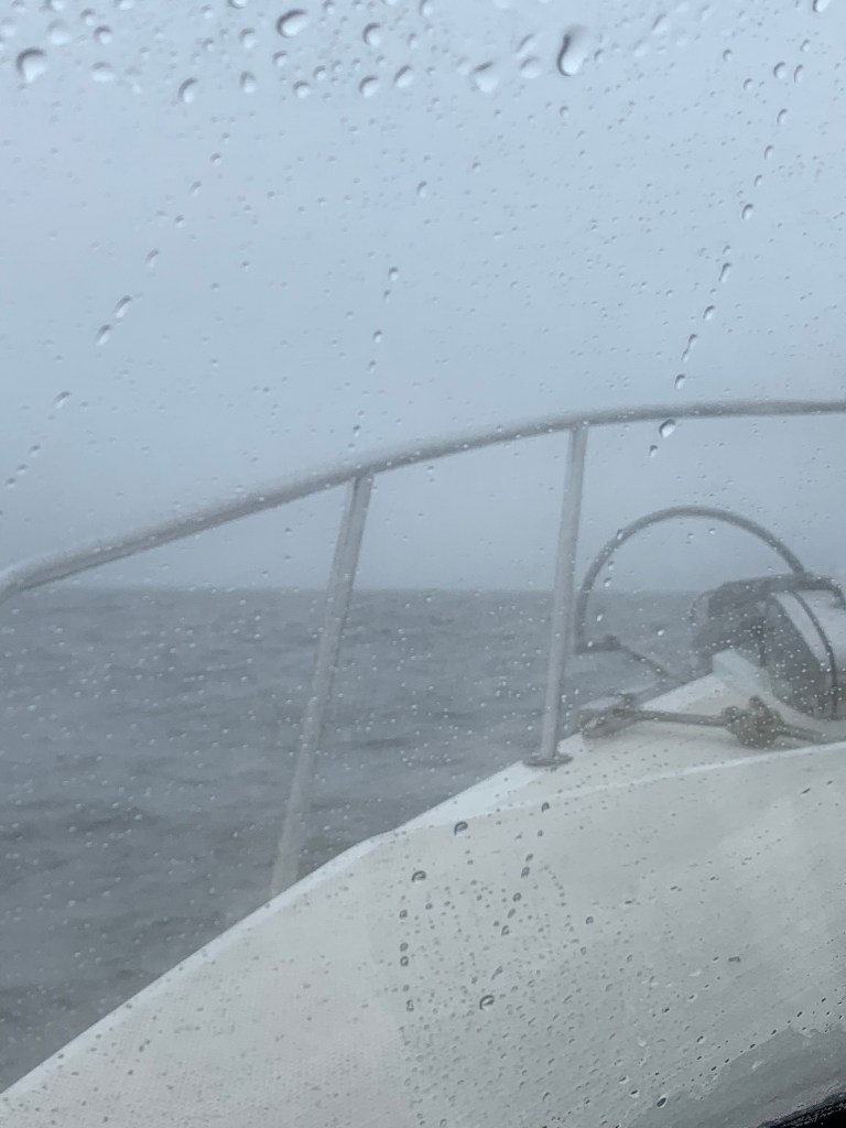
Initially the water was smooth as we headed south, but became choppy after several miles. There was plenty of fetch for the breezy southeast winds today, so we paced ourselves and bounced through at 7 mph. There were five tankers anchored in or along Trincomali Channel, and we saw one more enter the channel via Active Pass late in the afternoon. Is this standard or is there more to the story?

Latest mechanical issue – our freshwater pump ceased to function yesterday. It had intermittently not turned on when needed, leading me to suspect a wiring connection rather than the pump itself. I carry a spare pump, so can replace it if necessary. The pump is located in the compartment covered up with my cockpit storage box, so I’m waiting until we arrive in Friday Harbor tomorrow where I’ll have a little dock space to work with.

Thursday, September 9, 2021

James Bay to Friday Harbor

Miles: 30

Hours: 3.4

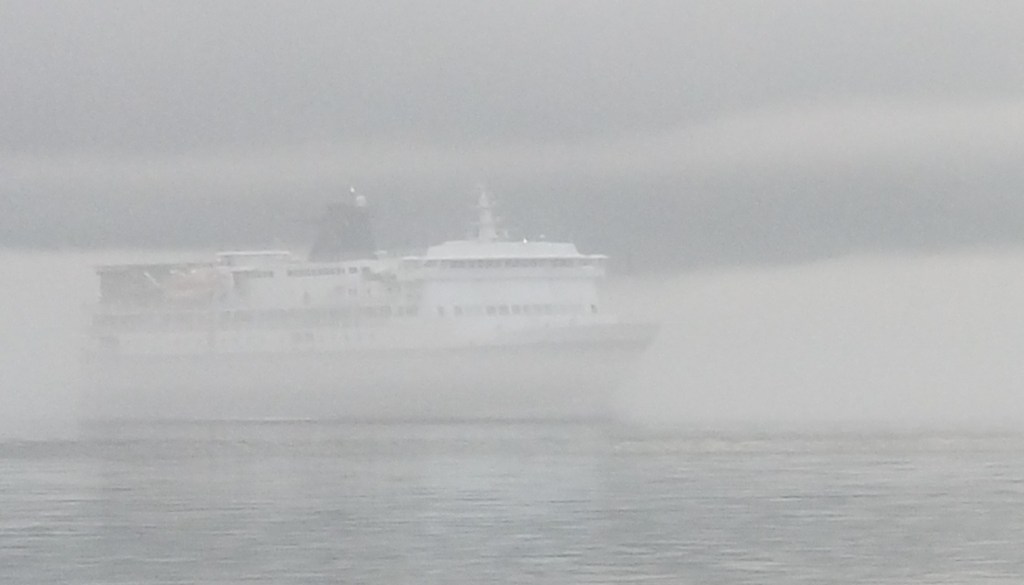
Everything was calm when we awoke this morning and turned south out of James Bay at 7:00 am. The busiest part of our morning was Captain Passage to Swanson Channel, where we had to dodge three separate ferries running across that channel between North Pender and Prevost Islands. In general, it seems as if the boat traffic in the Channel Islands is higher than during our transit in June.

Not much else exciting to report, as we had smooth seas for the run to Friday Harbor. I submitted our entry report via the CBP ROAM app just after we crossed the border. The customs officer in Friday Harbor initiated a video call, reviewed our information, and welcomed us back to the U.S. – very efficient and convenient.

Crossing back into U.S. waters

After stopping at the fuel dock for enough gas to get to Everett tomorrow, we pulled into our slip and finished a couple tasks/repairs. I replaced the inoperative water pump with my spare and put a new rechargeable battery into the day/night solar fan in the head. 

It’s good to be back in the U.S. and hard to believe we’re only a day away from Everett, where we started three months ago. We’re planning to transit Deception Pass at the 1:00 pm slack and make it to Everett later in the afternoon.

Friday, September 10, 2021

Friday Harbor to Everett

Miles: 68

Hours: 7.3

Total Miles (on the sea portion of this trip): 3237

Total Hours running the motor on this trip: 1275.5

USS Ralph Johnson (Photo Credit: Les Rohlf)

The U.S. Navy greeted our arrival at Everett this afternoon with a destroyer escort. Actually, the USS Ralph Johnson (DDG-114) was SLOWLY approaching the Navy Base as we arrived from the south, and we didn’t feel it would be appropriate for us to blast past the ship and her escorts into the narrow channel.

The rest of our trip from Friday Harbor today was fairly uneventful. I would not have minded spending an extra day in Friday Harbor, but the weather for the next couple days looked less agreeable than today’s. We left the marina at 9:00 am for the 25-mile run to Deception Pass and a 1:00 pm slack. I wasn’t sure what to expect as the ebb tide flushed us through Cattle Pass at the south end of San Juan Island into the westerly winds on Strait of Juan de Fuca. The waves were not too high, but were confused as we made the transition. It would definitely be challenging with a stronger ebb and/or higher winds.

We kept a fairly slow pace since we had plenty of time, arriving at Deception pass about 30 minutes early. A sailboat went through the pass first, and a train of five other boats formed up behind her about 15 minutes ahead of slack. The sportiest aspect of this passage involved avoiding the dozen or so small fishing boats all congregated below the bridge. We had smooth water on the east side of Whidbey Island for the rest of the way into Everett. There was no large commercial traffic to contend with on today’s route.

We’re thankful to have returned to Everett without injury to ourselves or Intuition. We’ll spend the next few days here cleaning up, loading the truck, and preparing for the drive back to St. Louis via our son’s home near Davis, California. At this point any descriptions of our experience feel like understatements – this has definitely been a “First in a lifetime” trip for us. Thank you all so much for your prior accounts, recommendations, and encouragement throughout this adventure.

Kel’s Musings

We often saw a seal pop up its face each time we entered a bay along the trip. We started calling it “Everett.” When we woke up after getting back to Washington, there was “our” seal resting on the dock near our boat.

A good ending leaves you wanting for more. As we tied off to slip 3 at Port of Everett marina, my emotions were varied. My niece asked how I felt, and I replied happy, sad and accomplished. I haven’t cried yet, but when I do it will be a mixture of happy sadness. Les kindly reminded me there are more adventures ahead.

A good story leaves you with a desire to know more, to wonder how do the characters go on after the conclusion. Just like a great novel, my mind will return to scenes, nuances, particular details and memorable characters and poignant moments along the way.

Just as the waves are confused as tides and winds transition, I’m certain when I wake up at home I’ll be a little disoriented. Wondering why the bed’s not swaying or why the shower doesn’t take quarters or why there’s not a raven or eagle greeting me each day.

I don’t like endings. I work through transitions. I look forward to more adventures. I still wonder what’s in God’s vast pocket.

On your feet now—applaud God!
Bring a gift of laughter,
sing yourselves into his presence.

For God is sheer beauty,
all-generous in love,
loyal always and ever.

Psalm 100: 1, 4 (The Message)


Port McNeill to Lund (September 3-6)

Growler’s Cove

Words by Les and Kel Rohlf

Photos by Kel Rohlf (unless otherwise indicated)

Kel’s Musings

The sun painting the clouds in Thurston Bay

What do they say about “red sky at night?”

Delightful.

Being able to stay at marinas on the way back through British Columbia waters has been refreshing. We checked our log book and apparently we’ve spent more days at marinas than anchorages on this trip. We stayed at our last marina in Canada last night in Lund. I woke up at 5am to a night sky sparkling with stars, and spied a couple familiar constellations: Ursa Major, the great bear and Orion, the protector. I sat for about 20 minutes savoring the quiet, still morning. Not long enough to see the sunrise, but I did hear a rooster crow and listened to the wake of a cruising boat lap against the breaker wall, and gently rock our boat. I climbed back into the boat and then the berth to sleep in.

We slept in until 8:00am. The only place open this morning at Lund was the grocery store, the gas dock and the garbage collector. Yesterday was Labor Day, so we celebrated by taking showers and doing laundry. All the cute shops and the local bakery closed by 4pm, it seemed. On our journey, Les has been on the hunt for the ultimate cinnamon roll. We were disappointed that we missed the famed delicacy in Lund. They are closed on the Tuesday after Labor Day, and we are heading south to keep our plan of getting to Everett, Washington by the weekend.

Laundry time

On the way to Lund we had williwaw weather and wonderful weather. I enjoyed both. (Williwaw weather, as a reminder, is what Alaskan locals call a windy stint of weather.) We weathered the wind in Growler’s Cove for a day and a half. I didn’t mind. I baked a cake, took a nap and caught up on some reading.

The day we left the cove, was calm and eerily foggy, but the navigator and logistics specialist got us to our next safe haven. By the time we anchored it had turned into a lovely sunny afternoon. I didn’t mind. I listened to a sea lion exhale, watched the clouds shape shift and read some poetry. In the evening, we ate leftovers and watched the sun set over Thurston Bay. Our two neighbors tooled around in their dinghy’s either checking their crab pots or taking their dog to shore. The golden retriever sat in the dinghy waiting for his driver. They would approach the rocky shore and the dog jumped off. The driver puddled along the shore, and after a bit the dog came out of the woods and jumped back in, to ride back to their boat. It was a delightful pre-dinner show.

I’ve noticed that I really enjoy a good balance of rainy, windy days and calm, sunny days. A few days in port mixed with a few days at anchor is my sweet spot as a boater. I notice Les is really at ease when we’re either place, too. But I suspect he enjoys the solitary times at anchor more. I like the ports for walking, exploring and of course, finding or shopping for treasures. In Port Mc Neill, we found a discount clothing store, so I added comfy flannel pj bottoms and a cozy, soft hoody to my wardrobe. I’ve found in our travels a good place to find art supplies and trinkets is at the local pharmacy. It reminds me of a general store with everything you might need or want as a sojourner on these paths. I found glue sticks, index cards, a pencil, travel size notebooks and cute note paper.

In Lund, as I said most of the shops were closed. The grocery store had trinkets and souvenir clothes, but I really wanted a sweater from the bakery/bookstore/boutique, which alas was closed. So it seemed no cinnamon roll for Les, nor a boutique sweater for Kel.

While I was at the laundromat Monday night, Les ordered and picked up dinner at the only open restaurant. We could have dined in, but the dryer was taking forever, so we ordered take out. The only thing on the menu for take out was fish and chips with coleslaw. We didn’t mind.

Laundromats often double as a free library and clothing exchanges. People leave their used magazines or books for the next person. They leave clothes behind, sometimes by mistake and other times there is a pile that the laundromat or somebody leaves for you to browse through and take if you want. The only thing in the take away box was a stray sock and a single baby bootie…and a gently used, oversized Kismet brand sweater. I took this as fate, and added it to my wardrobe.

Free sweater and new yummy hoodie

Les’ Notes

Friday, September 3, 2021

Port McNeill to Growler Cove

Miles: 22

Hours: 3.5

What do they say about “red sky at morning?”

We were planning to make at least Port Neville or get beyond Greene Point Rapids if the weather held. There are gale warnings up for strong southeast winds with a front due to arrive tonight. My hope was that we’d have a morning of light winds in Johnstone Strait, so that we could make some time and be in a protected location in advance of the highest winds tomorrow.

Unfortunately, the southeast winds had already begun by the time we pulled out of Port McNeill at 7:30 am. With the eastbound flood tide just beginning, the southeast winds created a messy chop. As the morning continued, so did the opposing winds, and the waves in Johnstone Strait continued to build. Not wanting to continue for four or more hours in those conditions, we pulled off the strait into Growler Cove. The opening of the cove faces west, so we anchored in 25 feet near the head of the cove for best relief from the very strong southeast winds expected tonight and tomorrow.

We had Growler Cove to ourselves all day, relaxing and catching up on a few items (and a nap) while the winds built on Johnstone Strait. It was breezy in the anchorage, but only enough wave action to gurgle against the hull. We may end up staying here tomorrow if the Gale Warning continues for Johnstone. If the wind lets up a little, we may try to make some progress once the ebb tide begins in the afternoon and we’re not dealing with strong winds opposing the tide.

Saturday, September 4

Growler Cove

Friday night was raucous with wind, rain, and noise from our front hatch canvas rain cover rattling in the winds. Note to self – don’t put up the rain cover when strong winds are expected. The wind didn’t seem to abate during the day on Saturday, so we stayed put.

A sailboat entered the cove later in the afternoon and became our only neighbor. The wind died about 7:00 pm and became calm as night fell.

Growler’s Cove


Sunday, September 5, 2021

Growler Cove to Thurston Bay

Miles: 64

Hours: 7.3

The water in Growler Cove was still when we awoke. Motoring toward the exit into Johnstone Strait, we could see thick fog except for the north side of the strait. As we turned eastward into the strait, we started scanning radar and AIS for any conflicts. I had about half a mile of visibility, with a clear view along the northern shore, so we continued at a slow cruise speed. A large fishing boat passed in the opposite direction, followed by the Alaska State Ferry Kennecott, both of which we saw only at their nearest point of less than half a mile. The Kennecott was the only vessel other than mine from which I heard a foghorn today.

Alaska State Ferry Kennecott sounding its foghorn

The fog was patchy for the next several miles, and we entered a thick section that lasted 8 or 10 miles until we popped out just past Port Harvey. The thick fog is spooky, since you can’t see very far, but also frustrating, as it’s challenging maintaining a straight course with little visual aid. This is a situation where a course maintained via autopilot would allow you to focus on watching radar, AIS, and the water ahead for things like logs or kayaks. Especially when traveling slowly, I always seem to be 20 degrees from my intended course or in the process of over-correcting.

Captain Les checking the charts

There was some light fog as we approached Race Passage, but became clearer throughout the day. We arrived at Race Passage just after slack current in Johnstone Strait, so Race Passage was a little more placid than when we went through westbound on June 14. We caught up with Sybille and Bo on SYBO just after Ripple Point and chatted with them on the radio before they turned up Discovery Passage and we continued east into Nodales Channel.

SYBO

We’ve anchored in the northeast corner of Thurston Bay Marine Park behind Block Island in 45 feet. It’s a calm, gorgeous afternoon. Our plan is to stay in Lund tomorrow night before striking back across the Strait of Georgia on Tuesday or Wednesday.

Kel spent the afternoon soaking in the sun (Photo Credit: Les)
Sunset at Thurston Bay (Photo Credit: Les Rohlf)

Monday, September 6, 2021

Thurston Bay to Lund

Fog and Kelp (Photo Credit: Les Rohlf)

Miles: 48

Hours: 5.3

With low slack, turning to flood at Dent Rapids forecast for 10:33am, we left Thurston Bay at 8:30am to give us plenty of time to cover the 11-12 miles. A big fog bank sat at the intersection of the Nadales and Cordero channels. We fell third in line behind a sailboat and a large cruiser as we approached Dent. We maintained our spacing on the other two boats via radar, and the fog lifted during the last few miles prior to the first rapid.

The big cruiser went through a few minutes early, the sailboat hit Dent at slack, and we followed him by a few minutes in very calm water. The open water northwest of the rapids was pretty swirly as we waited for slack, but the main flow of water was smooth during our transit. The sailboat was going pretty slow and would likely be a little late for Gillard, so we accelerated and passed him in the bay between Dent and Gillard. We went through Gillard at slack time and Yuculta a few minutes early without incident. It was interesting to see the numerous resorts and fishing lodges in this area.

After fixing lunch, we ran on plane the rest of the way to Lund and arrived here about 1:30pm Shower, laundry, and someone else’s cooking were this afternoon’s agenda. Horror of Horrors – Nancy’s Bakery will be closed tomorrow – no cinnamon rolls for me.

[Jesus] told them, “You have a saying that goes, ‘Red sky at night, sailor’s delight; red sky at morning, sailors take warning.’ You find it easy enough to forecast the weather—why can’t you read the signs of the times? (Matthew 16:2-3 The Message)

Shearwater to Port McNeill (September 1-2)

More whale sightings in Fisher Channel

Words by Les Rohlf Photos by Kel Rohlf

Les’ Notes

Wednesday, September 1, 2021

Shearwater to Millbrook Cove

Miles: 72

Hours: 6.6

Today’s leg made me a little nervous, as it assumes very good and settled weather through at least mid-day. Millbrook Cove, our planned anchorage is located very close to Cape Caution. The advantage is that it shortens the crossing of Queen Charlotte Strait as much as possible; the disadvantage is that the arrival route is nearly as exposed as Cape Caution itself. I had marked Fury Cove, a little farther north off of Fitz Hugh Sound, as an alternate destination in the event we couldn’t comfortably get to Millbrook Cove.

Almost There fired up her thrusters and pushed away from the dock as we were preparing to leave this morning. We backed away shortly thereafter and were headed toward Lama passage by 7:00 am. Kel finished posting updates and photos as we passed Bella Bella and still had cell coverage.

Leaving Shearwater at first light; other neighbors

We ran on plane most of the day, with the sea state in Fisher Channel and Fitz Hugh Sound varying from smooth to choppy, but never enough to make the ride uncomfortable. I saw a whale breach from a couple miles away as we neared Fog Rock. By the time we got close, they were done with the theatrics, but we got some good photos before they dove and continued north.

It was so calm today that we even discussed whether it made sense to keep going and cross Queen Charlotte Strait this afternoon. As we neared Cape Calvert, where you’re more exposed to the open ocean, we got our answer with the rising swells. We were able to stay on plane all the way to Smith Sound and the entrance to Millbrook Cove, but the big (and in some cases beamy) swells made it clear I didn’t want to push through another 30 miles in these conditions.

We meandered our way among the rocks and around the island that protect Millbrook Cove and anchored in 30 feet on an 8-foot tide.  The inner section of Millbrook Cove is protected on all sides from any wave action in Smith Sound. This is part of the low, rocky coastline, so there aren’t high hills to protect from extreme winds, but it seems about as secure a spot as possible this close to Cape Caution.


Sunset at Millbrook Cove

Thursday, September 2, 2021

Millbrook Cove to Port McNeill

Miles: 65

Hours 4.8

Millbrook Cove was amazingly quiet, and we were the only ones there last night. There was just a slight breeze in the anchorage when we awoke to check the weather. It sounds as if winds in Queen Charlotte Strait will shift around to the southeast and build over the next day, but this morning should remain light. Reports from Egg Island and Pine Island indicated waves of half-meter or less, so today looks like our best opportunity to cross for the next 2-3 days.

Leaving Smith Sound to cross Queen Charlotte Strait

Smith Sound was fairly calm as we exited the cove and pointed southwest toward Cape Caution. The waves and chop built as we continued around Cape Caution and pointed southeast into the strait. We were able to stay on plane and make good time, but the chop on top of the low swells made for busy driving. We had no more than two miles of visibility for most of the trip around the cape. At several points we could barely see the land a mile off our port side.

Alaska State Ferry Matanuska

My route for the southbound crossing was different from our crossing in June. We stayed close to the mainland coastline after passing Cape Caution, as opposed to heading directly south toward the God’s Pocket area off the north end of Vancouver Island. Less confident about the weather this time, I wanted to stay within a shorter distance of protected harbors and wait until we were deeper into Queen Charlotte Strait before crossing. We met the northbound Alaska State Ferry Matanuska in the narrow Millar Passage. We hugged the Millar Islands side of the passage as she passed.

Whale tail off the bow of our boat

We saw a whale ahead at the east end of the Millar Islands. We watched him sound, then I switched my attention to avoiding rocks/preparing for the ferry’s wake/cross-checking radar and AIS when Kel exclaimed, “There’s a whale right next to you!” I looked to my right as a second whale that we hadn’t noticed sounded within about 25 yards of us. Sorry, no photos of that one.

The sea state calmed considerably as we tuned a few degrees to starboard and pointed toward Port McNeill. The chop increased a little in the middle of the strait, but not enough to slow us down from our 15-mph pace. Arriving in Port McNeill shortly before noon, we filled up with gas and walked to the grocery to stock up for the next several days. After our gloomy morning, Port McNeill was sunny and clear this afternoon.

Not sure exactly what route we’ll take for the next several days. There’s another blow coming tomorrow and Saturday that will bring strong winds to Queen Charlotte Strait and the Broughtons. We’ll head east part way up Johnstone Strait before angling north and exploring between here and Desolation Sound.

“Let everything that breathes offer praise to the Lord. Alleluia.” Psalm 150:6 NCB

Prince Rupert to Shearwater (August 29-31)

Hanging out with the super yachts (photo credit: Les Rohlf)

Words by Les and Kel Rohlf

Photos by Kel Rohlf (unless otherwise indicated)

Les’ Notes


Sunday, August 29, 2021

Prince Rupert to Lowe Inlet

Miles: 68

Hours: 9.5

Prince Rupert harbor was busy with several arrivals/departureswhen we left at 7:15am. We experienced showers off and on all day with some occasional sunshine. Waters were generally smooth except for choppy sections in the open water south of the harbor and in sections of the Grenville Channel where the southwest wind could funnel through.

We caught up with SYBO near the north end of Grenville Channel; they were sailing into the southwest breeze and were planning to go offshore today and stay there for a couple hundred miles. Winds forecast from the northwest for the next few days should help their progress.

We were the first boat to arrive at Lowe Inlet at 4:30 pm and anchored in front of Verney Falls. You can anchor close to the falls, and the current will keep your boat from swinging. Two more boats arrived and anchored later in the day.

We grilled steaks for dinner and watched as a black bear fished for salmon jumping in Verney Falls.

Monday, August 30, 2021

Lowe Inlet to Swanson Bay

Miles: 65

Hours: 9.6

We left our anchorage at 7:00am, shortly after sunrise. There were two bears at the falls as we prepared to leave. As we entered Wright Sound just south of Hartley Bay, we noticed a huge fogbank the width of Douglas Channel, despite it being otherwise clear and sunny this morning.

As I commented about not wanting to have to go through that, I saw a whale breach close to the bank and just east of Cape Farewell. Several whales breached, some entirely clear of the water. Another was tail slapping as the others breached. We just watched from a mile away, enjoying the show rather than trying to get closer for photos. Several other whales appeared as we transited Wright Sound and McKay Reach.

Clouds and showers closed in as we headed south in Fraser Reach and pulled into Swanson Bay about 3:30pm. The bay is not long or far removed from the main channel, but offers protection from the forecast northwest winds. I was unable to get the anchor to set in the northwest corner of the bay, so we moved to a point south of the old pulp mill ruins. We’re anchored in 45 feet of water, with a little more room to swing. I commented that the bay is a nice place unless someone big comes along through the nearby channel. Not more than an hour later, the Northern Expedition chugged up Fraser Reach and passed little more than a half mile away.

Northern Expedition (photo credit: Les Rohlf)

She was 3.5 miles away by the time her wake hit us. The wake turned out to be not bad, unlike the steep 3- to 4-foot rollers we experienced in the narrow Grenville Channel from one of her sister ships.

Tuesday, August 31, 2021

Swanson Bay to Shearwater

Miles today: 79

Hours: 6.2

Low clouds greeted us this morning, but it remained dry. We headed out of Swanson Bay at 7:15am and into a choppy Fraser Reach. The good news – this was the worst sea state we’d see all day. I planned a little different route to Shearwater than we had taken on our way north to both allow for better protection and to see some new scenery. After breakfast we ran on plane to make time on this longer mileage day.

We turned into Hiekish Narrows, which leads to a point farther north in Finlayson Channel than we’d previously been. After traveling south to a point abeam Klemtu, we turned east into Jackson Passage. Jackson Passage includes Jackson Narrows at its eastern end where it meets Mathieson Channel. This was a pretty passage and worth the trip. There are a couple inviting anchorage areas at the eastern end. 

The sun finally broke through as we headed south through Mathieson Channel, a very pretty passage with very little debris in the water. At its south end we cut across to Percival Narrows, which gives a protected route to Seaforth Channel, allowing us to avoid Millbank South. We went slowly through Percival, which looks a little scary on the charts but has plenty of water (we never saw less than 27 feet on today’s 10-foot mid-tide. We passed through during the ebb, but today’s drop was only 2 feet, so no issues with currents.

After turning into Seaforth Channel, we pushed the throttle up and ran across the big, wide swells for a few miles until their affects dissipated. The sky was clear when we passed Dryad Point and turned into the harbor at Shearwater Resort. There seems to be more happening at Shearwater than during our first visit in June. We enjoyed wandering the grounds and eating ice cream on a sunny afternoon. While not really busy, all the facilities are open. There are a few other cruisers docked here, along with three 100+ foot mega-yachts.

Kel’s Musings

Since the first part of transit across Canadian waters retraces waterways that we had traveled before, I set my sights on organizing my journals and art supplies to use while we cruised. Thankfully we’ve had fairly calm waters, so most of the time I sat in my aft seat in our kitchenette puttering away.

Les chose two anchorages we hadn’t been to on our travels to Alaska. After leaving Alaskan waters, I didn’t think we’d see anymore bears or whales because we hadn’t seen any on the way up north. But that was June, and in August the salmon are running and the whales are still active.

We are cruising 8 hour days average now to cover the 750 plus miles to return to Everett, Washington. So when we drop anchor we’re both pretty tired, and still have to make dinner and get settled for the evening. At Lowe Inlet, our first anchorage along this route, we anchored right next to Verny Falls that pours out of a lake. As Les pulled out the grill, there were intermittent rain showers. The first surprise of the evening was a brilliant rainbow arcing over the waterfall.

Lowe Inlet

After the rainbow and a delicious steak dinner, I decided to get some video of the waterfall. Les was plotting the chart for the next leg of the trip. As I watched the waterfall I noticed some movement at one edge. I hollered to Les, “I think I see a bear.” He came out and sure enough a black bear was catching salmon, and then climbing up a rock to go eat it. The bear repeated this feat three or four times, and I was able to get some decent photos. What an unexpected evening of entertainment!

Bear fishing for salmon

The next day we were cruising to Swanson Bay. On the way we had to cross a couple channels and Les noticed whales breaching, and one tail slapping. I spent the rest of the day doing some more work with my art journals and we listened to Robinson Crusoe on CD for about an hour. The rest of the time we enjoyed the gorgeous scenery. This part of the trip is spectacular, and we feel very fortunate to see it again, and also hope to check out some new spots as well.

Today we arrived at Shearwater, a resort near a First Nations town called Bella Bella. Last time here, we were only able to dock for gas, and then anchor in a nearby bay. This time we have a moorage at the resort marina. Just up the walkway we were able to enjoy all the amenities: a laundry/shower facility, an ice cream shop which also sold various items including art supplies, a well stocked grocery and a waterfront restaurant. We partook of all.

Art supplies!

It’s amazing the difference of being able to stretch our legs and get what we need or want. It was a nice break after three days of cruising.

Ketchikan to Prince Rupert, BC (August 26-28)

One last trek down the steep walkway at Ketchikan
Last look at Ketchikan waterfront downtown

Words by Les and Kel Rohlf Photos by Kel Rohlf

Kel’s Musings

Prince Rupert, BC

Arriving at Prince Rupert marks the last leg of living on the water, we will traversing the waterways of British Columbia back to Everett, WA to put the Intuition on its trailer. Then we will hit the road trip to head back home, first swinging by California to see our son and daughter-in-law for a visit.

As we waited for the harbormaster in Prince Rupert, we noticed Sybo pull up to the customs dock. We met Sybil and Bo in Ketchikan in the Covid testing line, so we reintroduced ourselves and had a nice chat while they waited for customs. We went to get groceries, and they had moved on by the time we got back. We hope to catch up with them again on the way south.

Return trips are a mixture of familiarity, seeing different aspects of the route and longing to be back in our home port. After Prince Rupert we will retrace the route for about five days, then we plan to take an alternate path back to the Seattle area. We’ve heard great reviews of the Broughtons south of here. So we’re looking forward to some new experiences.

Transiting the Canadian waters will be much more relaxed this time as things have opened up. We are able to stay at marinas with showers, and walk around town to eat out, get groceries and shop at thrift stores. Prince Rupert had a nice Salvation Army store, where I found sundry art supplies. They also had Walmart, which was a bit disappointing. It had limited groceries with no fresh produce section. We got groceries at Safeway. We ate fish and chips at Breakers Pub, and found diner food at Naomi’s Grill for lunch on Saturday.

On Saturday, I also checked out Dollarama and Dollar Store with More. Found some fun art inspiration at both of them. (Not everything was $1.00…more like Five and Below pricing with Dollar Tree and Big Lots inventory. These two stores were very clean and well-organized.) I walked back to the boat, and Les went to Safeway to pick us up dinner from the deli there.

Prince Rupert another rainy port
Pay phone actually had a dial tone

It was refreshing to move about. Although the marina moorage prices were higher than Alaska, the harbormaster gave us 6 Loonies for the showers. 1 Loonie for three minutes. I budgeted my coins and enjoyed a 6min shower first day, and 3min shower today. A Loonie is a Canadian one dollar coin.

I also wanted to mention that I did finish reading Moby Dick, after trying to do so for the last twenty years. I bought Robinson Crusoe on CDs at a thrift store, so I plan to listen to that while we transit British Columbia waters.

Les’Notes

Thursday, August 26, 2021

Ketchikan to Foggy Bay

Miles: 46

Hours: 4.9

Took one last shower, checked out with the harbor, and grabbed a final bag of ice before we departed Ketchikan’s Bar Harbor South at 10:00 am. We stopped by Petro Marine on our way out of town to fill up with fuel.

Our plan for the southbound Dixon Entrance crossing is to take two days with a stop the first night in Foggy Bay. We originally wanted to take this approach, and I think it’s the only option given the narrow weather window that appears to be available.  Conditions are less than optimal for the crossing today, but will allow us to get to Foggy Bay. It looks like the weather will settle slightly overnight to allow the passage from Foggy Bay to Prince Rupert early in the day on Friday before the next ugly system arrives late that day.

We had a nice smooth ride down the Tongass Narrows and took the passage on the north side of Bold Island. We ran on plane and the ride was pretty smooth until we passed the entrance to Behm Canal. The waves weren’t terribly big but were directly beam on, making the ride and steering annoying. We stayed at the higher speed, since slowing down wouldn’t be comfortable, and made a left turn toward the islands on the east side of Revillagigedo Channel instead of the more direct route just east of Mary Island. We got better protection once we were against the eastern shore. As we continued south toward Foggy Bay, the waves became more disorganized, with larger swells, so we slowed down to 7 mph for the last 10 or 12 miles. The wind doesn’t seem too strong, but the waves haven’t yet calmed from the last couple days.

We followed the narrow channel into the inner portion of Foggy Bay. It’s a very pretty and extremely well-protected anchorage. I can hear the waves crashing against the rocks in the outer bay, but there’s hardly a whiff of wind and perfectly calm water here.

It sounds as if the weather will become extremely nasty by late Friday afternoon. The winds won’t be high early tomorrow and will be shifting from NW to SE, so hopefully we’ll be able to run at speed directly toward Prince Rupert in the morning.


Friday, August 27

Foggy Bay to Prince Rupert

Miles: 65

Hours: 7.8

Entering Foggy Bay
Calm and Clear at Foggy Bay

We woke up at 5:00am and I had just barely enough of a cell signal to get a couple light station reports. Green Island Light Station was indicating 2-foot seas, which is slightly more than I’d like, but will work. Winds are expected to decrease until noon, and then dramatically increase from the southeast as a front moves in late today. There are Small Craft Advisories and Gale Warnings all over the place, but they reflect the system due to arrive this evening. We pulled the anchor and started moving just after sunrise at 5:45 am. Unless the water was very flat, my plan was to take the longer route staying closer to shore and the available bail-out options should the weather and seas turn bad quickly.

Foggy morning getting to Dixon Entrance

The inner part of Foggy Bay was calm with good visibility, but the fog in the outside bay limited visibility to only ¼ mile. I turned on the fog horn, and we started the slog through messy, disorganized waves heading south toward Cape Fox. We passed several fishing boats as we ran approximately one mile offshore. We couldn’t see the shore, but were able to see the boats from about ¼ mile away and stay clear of their nets.

I was almost giddy when the waves subsided to long low swells with just a light chop as we got close to Cape Fox and the open waters of the Dixon Entrance. The fog relented a little and visibility increased to two miles. The 8:00 am Green Island report indicated 1-foot seas, so things seemed to be settling as I had hoped. Rounding Cape Fox, we pushed up the power and ran on plane. I decided not to get too greedy and take the shorter route toward Dundas Island, but passed just north of Lord Rock and took up a heading toward the north end of Finlayson Island. I wanted to keep a protected option rather than leave us in the shorter but more exposed Holliday Passage which runs just east of Dundas. Midway through that section of the crossing, waves became bigger again, forcing us to slow down to 7 mph for a little more than an hour until we could duck behind Finlayson Island. We also saw a lot more debris (i.e. big logs and trees) in the water through this section.

We fixed lunch while passing behind Finlayson Island. By the time we popped back out into open waters at the south end of the island, the waves were less steep and more on the nose. The sea state continued to calm and we were able to run on plane again for the last several miles before turning into Duncan Bay and north entrance to Venn Passage.  We dodged the Digby Island Ferry in the last narrow section before entering the Prince Rupert harbor about 2:00 pm. 

Our first item of business upon arrival was to check in with customs. We looked for the customs dock that we had passed 2 months earlier, and couldn’t find it. Apparently, it’s been removed, so we moved up to the Cow Bay floating breakwall, where there is a section spelling out “Customs” using yellow tape. We tied up there and called CBSA to report our arrival. After giving the agent all our information, she approved our entry and provided us a clearance number – much easier and less stressful than our last arrival.

View of Cow Bay Marina from Breakers Pub (Can you find the Intuition?)

There was nobody at the harbormaster’s office and no one answered the phone, so we motored over to the gas dock to fill up. Per the marina’s phone message instructions, we emailed a slip request, not certain we’d get a response late in the afternoon. We tied up to the inside of the breakwall and went to Breakers Pub for some dinner. While we were there the harbormaster contacted us and met us 30 minutes later to provide a more protected slip. In retrospect, I should have made a moorage request before leaving Ketchikan; I’ve become accustomed to the process at Alaska harbors where you just show up and request a spot or park in a designated transient section. Robin, the harbormaster, said that their season was rapidly winding down, and they’re now seeing very few southbound cruisers.  

It’s a relief to be tied up in Prince Rupert with a gale-force front arriving tonight. The weather window we had for this crossing was less than ideal, and I don’t think I’d want to make the crossing in worse weather. We were fortunate to have an accurate forecast and two days’ time to take a slower, less-direct, less-exposed route.