Kake to Ketchikan (August 22-25)

Kake marina at very low tide (Photo Credit: Les Rohlf)

Words and Photos by Les and Kel Rohlf as indicated

Les’ Notes

Leaving Kake and entering Keku Strait (Photo Credit: Les Rohlf)

Sunday, August 22, 2021

Kake to Salmon Bay

Miles: 71

Hours: 8.6

We weren’t able to make contact with anyone from the Harbormaster’s office at Kake. The only number is for the village, and nobody was there to answer on Saturday or Sunday. They were happy to take my payment information when I got in touch with them on Tuesday.

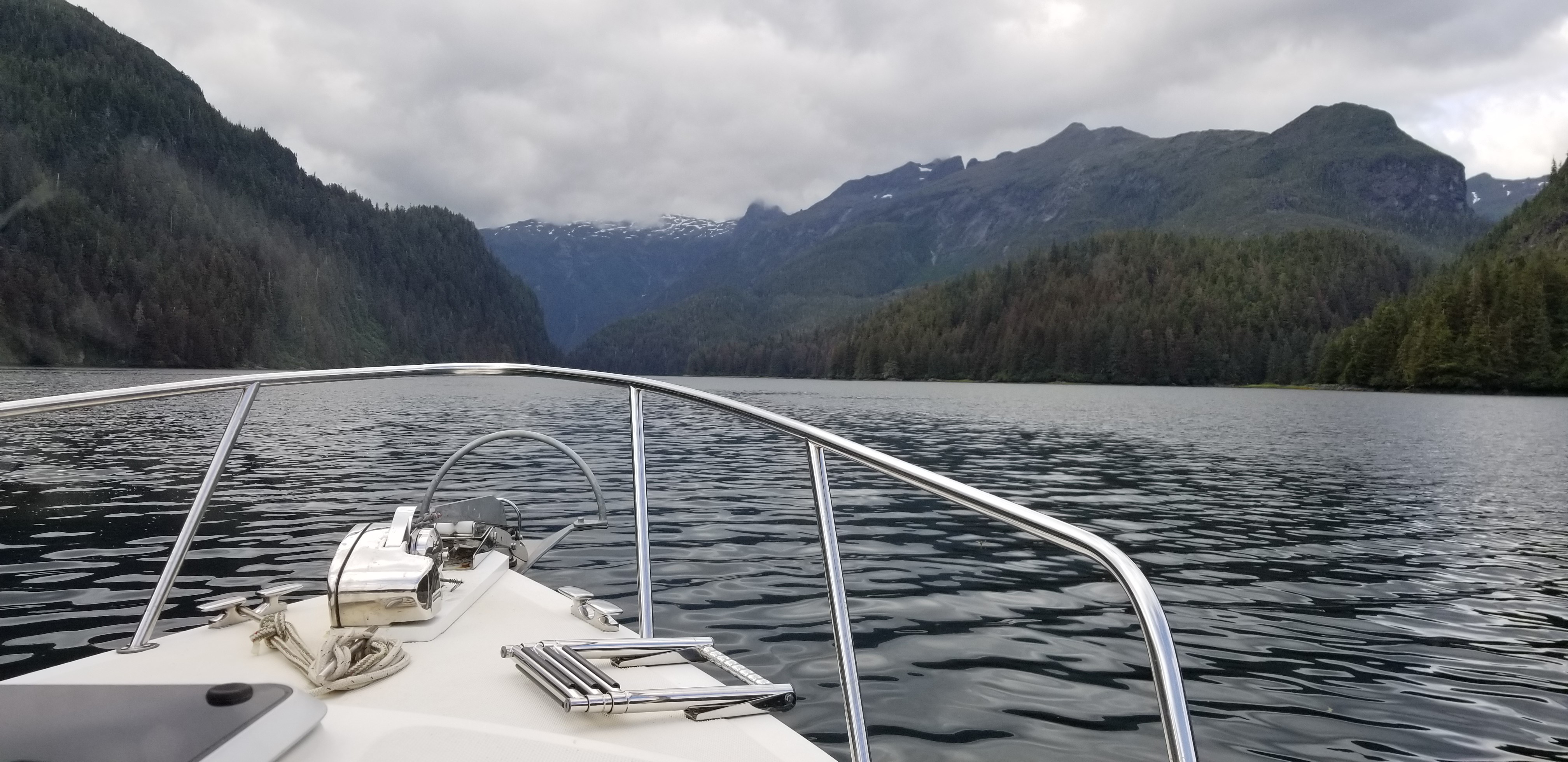
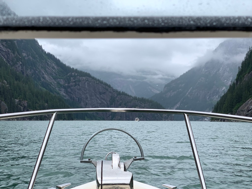
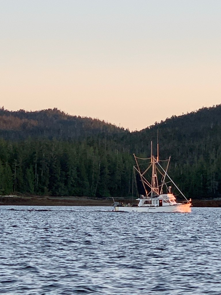
The plan for today was to transit Rocky Pass southbound and spend the night at Point Baker. Rocky Pass represents the middle section of Keku Strait, which connects Frederick Sound to Sumner Strait. The pass is a narrow often-shallow passage that winds its way through a patchwork of rocky islands between Kuiu and Kupreanof Islands. It’s an absolutely beautiful and remote area. Aside from a boat we met going through the pass, we saw no one else.

Rocky Pass, Les did a great job navigating, and Kel got to be the lookout for submerged rocks,
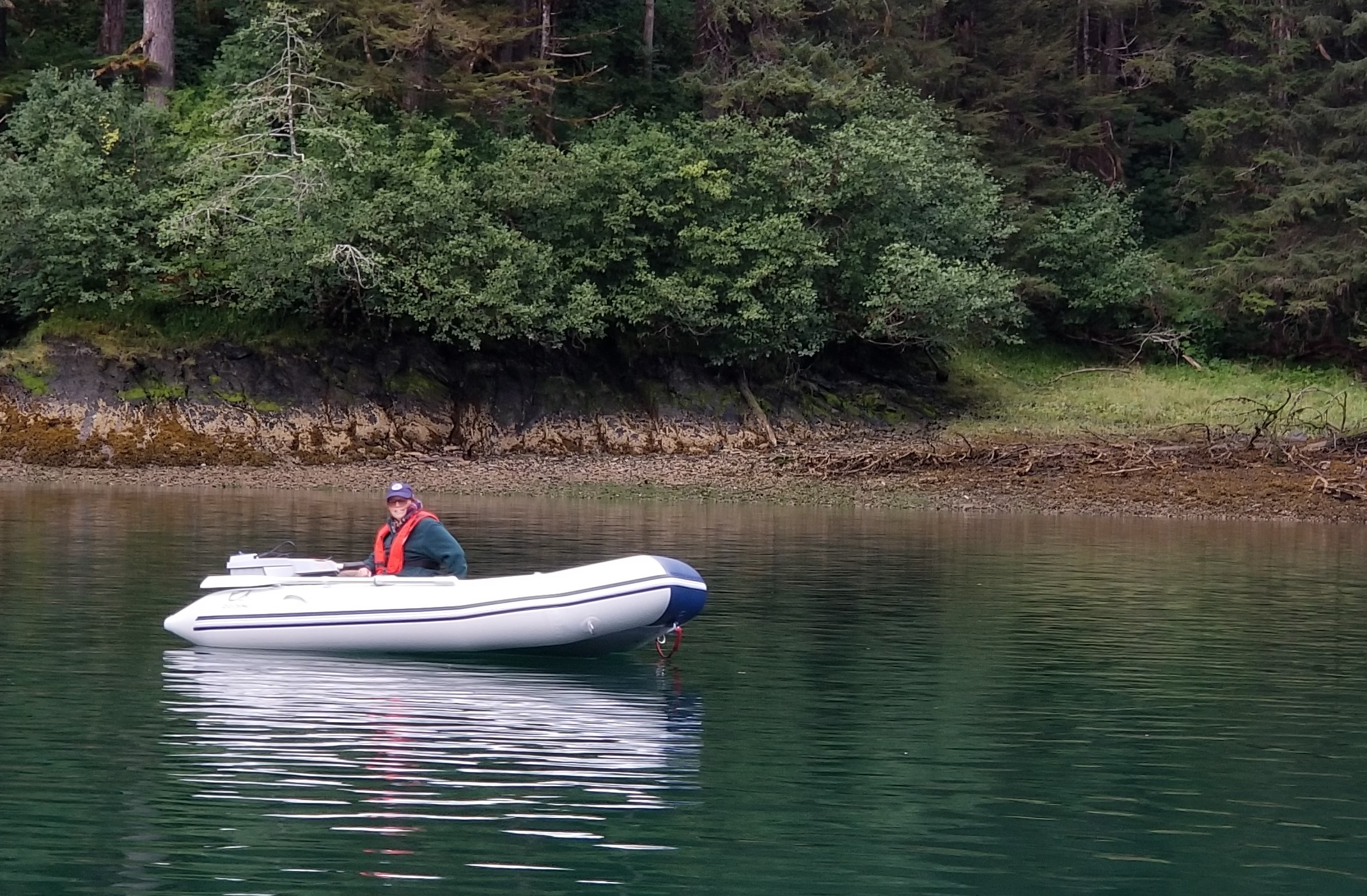
but mostly we just had kelp to dodge. (Photo Credit: Kel Rohlf)

At one time the shallowest sections of Rocky Pass had been dredged to a minimum of 5 feet, but recent reports are that it is much shallower. The best practice is to transit the trickiest sections (The Summit and Devil’s Elbow) at high slack tide. The tides from the north and south meet roughly between the two. High slack tide for today at The Summit was forecast for 2:26 pm. My plan was to arrive at the north entrance to The Summit no later than 2:00, so that we could be at Devil’s Elbow by 2:30. With last night’s being a full moon, there was a lot of water being exchanged with the tides, so getting the timing close would be critical.

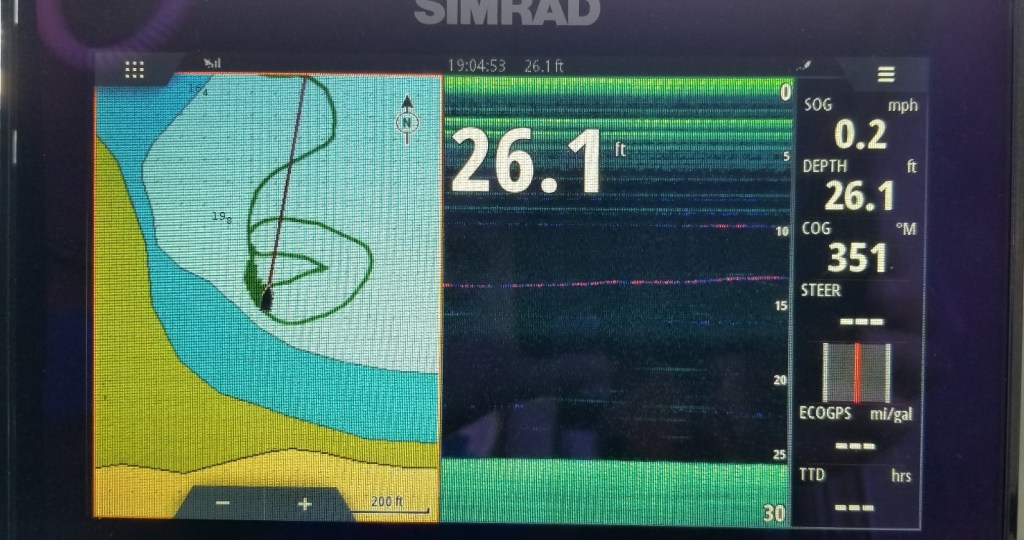
We left the Kake floats at Portage Harbor shortly after 10:00 am and meandered between the islands that separate Portage Passage from Keku Strait. Since it was a clear and sunny day, we could look across and see the snow-capped peaks of Baranof Island beyond Kuiu Island. All of Keku Strait was picturesque, especially today with light winds and clear skies. Heading south during the peak of the flood tide, we got a noticeable boost in speed through some sections. We arrived at the north entrance to The Summit at 1:50 pm. There was still just a little current at our stern, but no issues with steerage. The Summit has a couple very shallow turns, and its challenge lies in maintaining a course through the very narrow channel. With a 15-foot high tide, we saw slightly less than 18 feet a few times. I made a Securite call entering The Summit; another cruiser coming the opposite direction waited for us at the south end, as there’s really not much room for two boats to pass in this section.

Kel sitting on bow looking into the Summit passage (Photo Credit: Les Rohlf)
Rocky Pass, the other boat we passed is in the background of this photo. (Photo Credit: Kel Rohlf)

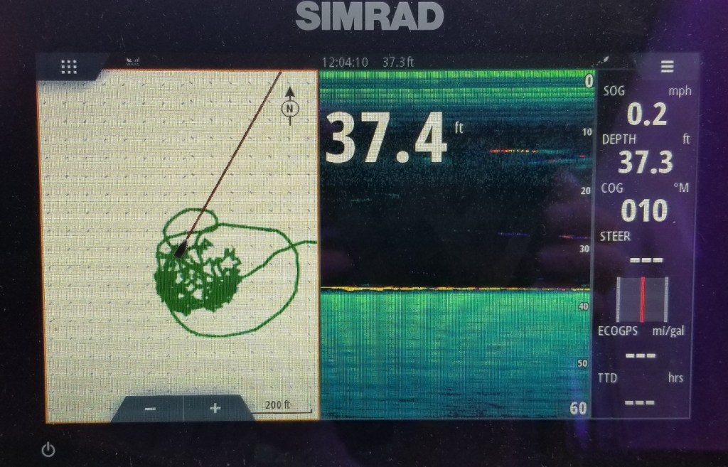
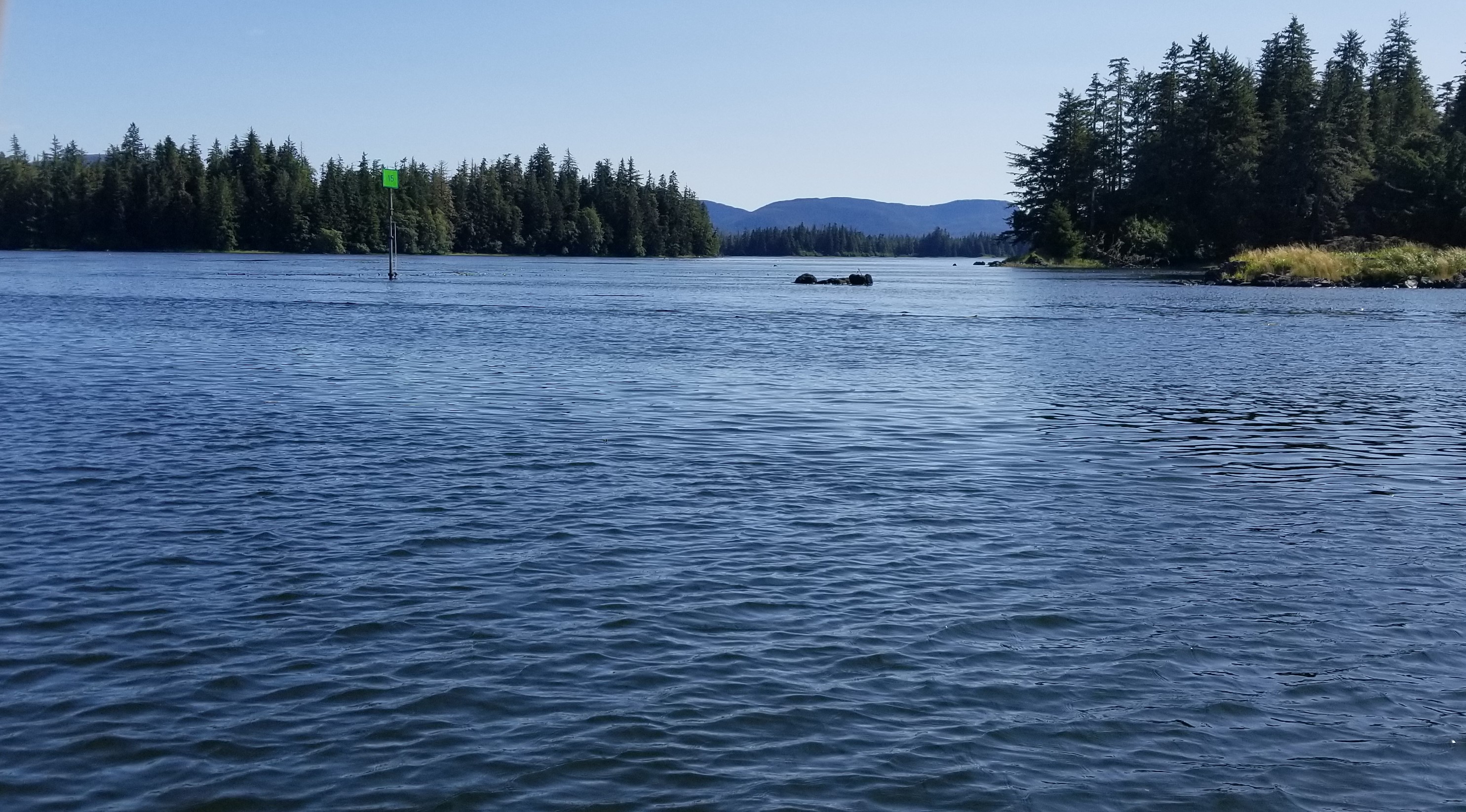
We arrived at Devil’s Elbow at 2:30pm and perceived no current through that area. Having now been through that section once, the tricky aspect is that you can’t see (at high slack) the two near-ninety degree turns that are required within about 100 yards of each other. The water shallows dramatically outside the channel. Today’s electronic charting makes the process far easier, especially since one of the channel marker (Green 13) was missing. I spent too much time looking for the missing green marker and slightly overshot both turns. At high slack I had a little more room for error and no pesky current trying to push me into a rock or mudbank. 

Devil’s Elbow (Mind the rocks!) Thankfully we did not see any submerged rocks and had plenty of depth to navigate Rocky Pass. (Photo Credit: Les Rohlf)

We crossed Sumner Strait and went to Point Baker. Point Baker is a small community (35 or so) in a well-protected cove on the northeast side of Prince of Wales Island.  There was room on the public dock, but everything was shuttered. In better times there has been a restaurant, store, and bar there. Rather than spend the night, we decided to put in a few more miles to shorten the day tomorrow. We stopped in Salmon Bay, an inlet just south of Sumner Strait in Clarence Strait. It’s fairly narrow and also shallow.

Monday, August 23, 2021

Salmon Bay to Ketchikan

Miles: 102

Hours: 12.4

Salmon Bay at 2am I saw the full moon (Photo Credit: Kel Rohlf)

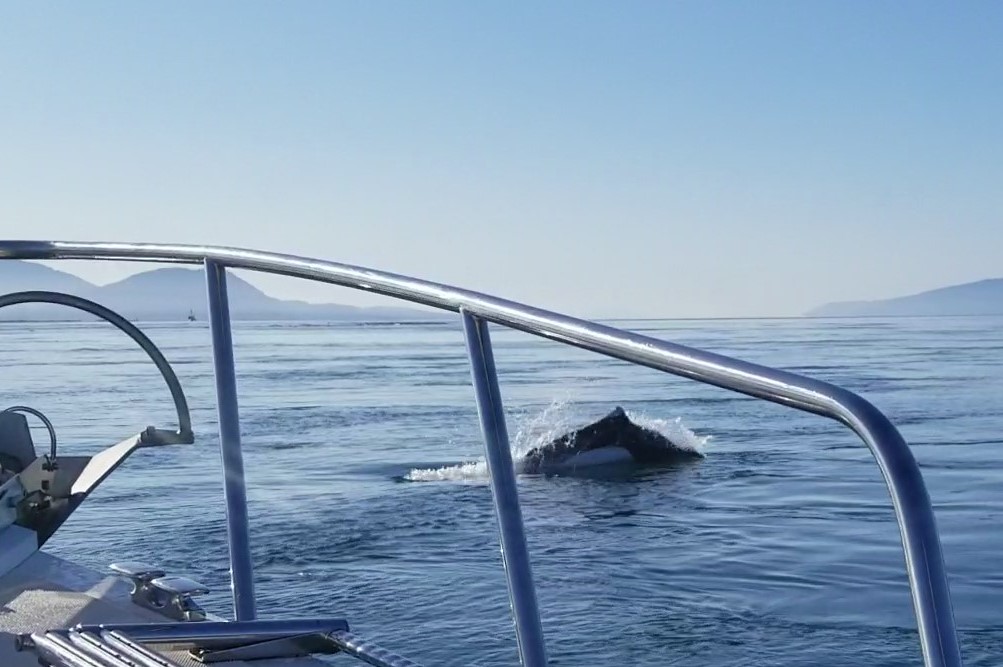
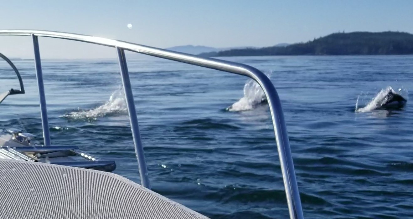
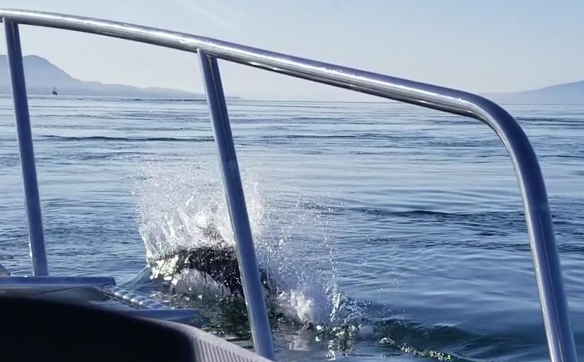
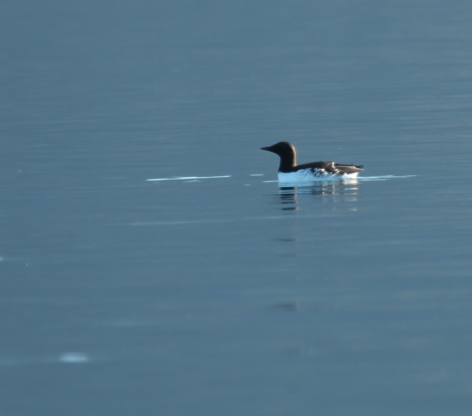
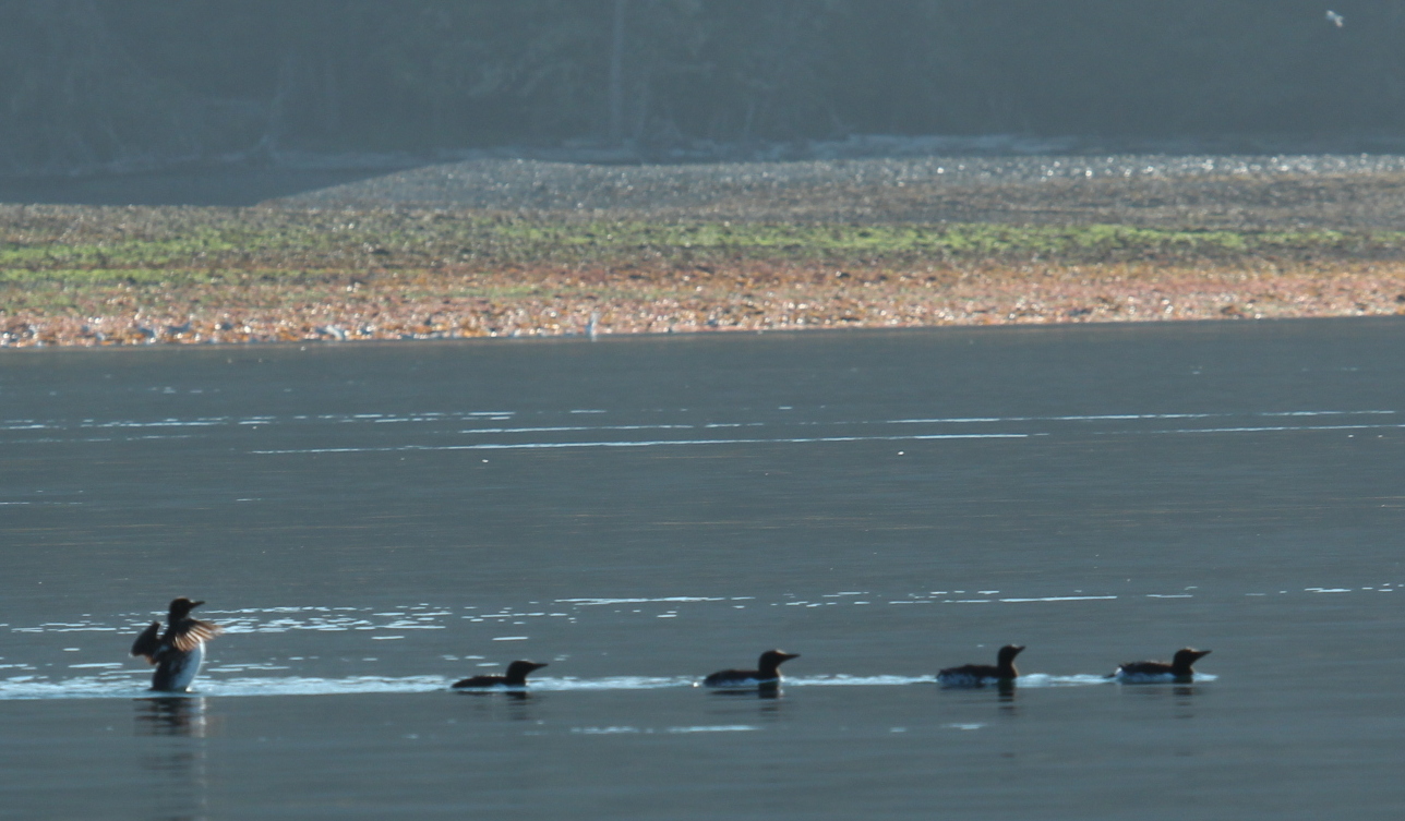
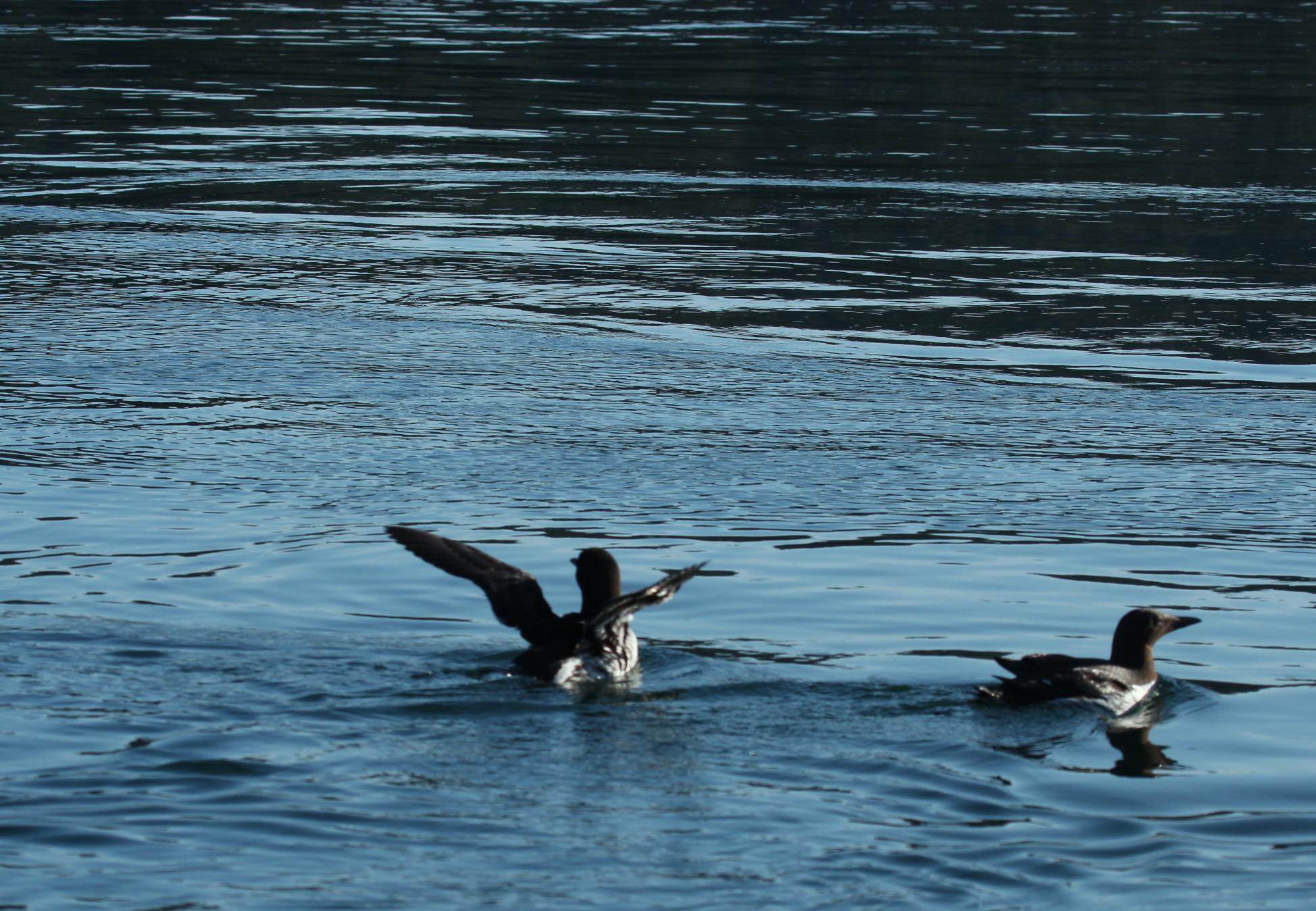
We headed east out of Salmon Bay toward Snow Passage at 7:00am. It was another clear, beautiful day with light winds. We saw some whales from a couple miles away near the north end of Snow Passage, but they were gone by the time we got there. Even though we arrived at close to low slack, there were some pretty strong currents running through this narrow area. During the last section of the passage, several Dall’s Porpoises popped up around the boat and flitted back and forth in front of us.

Dall’s Porpoise jumping by bow of boat (Photo Credit: Les Rohlf)
Very fast and playful Dall’s Porpoises (Photo Credit: Les Rohlf)
Dall’s Porpoise right off our bow, note their distinctive white side (Photo Credit: Les Rohlf)

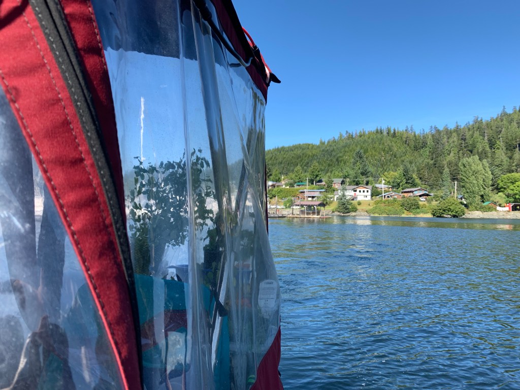
We took our time heading south through Clarence Strait, as I didn’t want to arrive at the entrance to Thorne Bay during the fastest of the flood tide. Thorne Bay reminds me of both Red Bluff Bay and Rocky Pass, with a few narrow and shallow sections connecting to longer, deeper bays. These narrow passages carry faster currents except at slack. We arrived at the town of Thorne Bay about 1:30 pm and tied off to their marina’s outer floating breakwall, which serves as the transient dock. Thorne Bay is a cute small town (450-ish) in a beautiful setting. There used to be a huge logging operation and pulp mill here. A lady we talked to later in Ketchikan had lived there for seven years during the logging days and said that at that time Thorne Bay was essentially a company town.

We stopped by the café (closed this week), then went to the market to grab a few impulse items. The shower at the marina was locked, and we couldn’t find anyone to open it. We decided to move on and make the 40-mile run for Ketchikan tonight, rather than stay in Thorne Bay. The weather looks spicy for the next couple days, so we determined a late-day run was no worse than waiting until tomorrow.

Leaving Thorne Bay at 3pm (Photo Credit: Kel Rohlf)

The day continued clear when we pushed away from Thorne Bay at 3:00pm, but the waves built as we crossed Clarence Strait toward Caamano Point and the entrance to Tongass Narrows on the other side of Behm Canal. The waves were mostly on our bow and weren’t dangerous, but 7 mph was as fast as we could go without having all our possessions end up in the middle of the cabin. A mild jab to the ribs from the dinette table when a wave hit us as I got up to fill my water bottle reminded me that moving around much in these conditions is not without risk. We joined a line of fishing boats returning to Ketchikan and entered the smoother waters of Tongass Narrows while avoiding two barge tows going the opposite way.

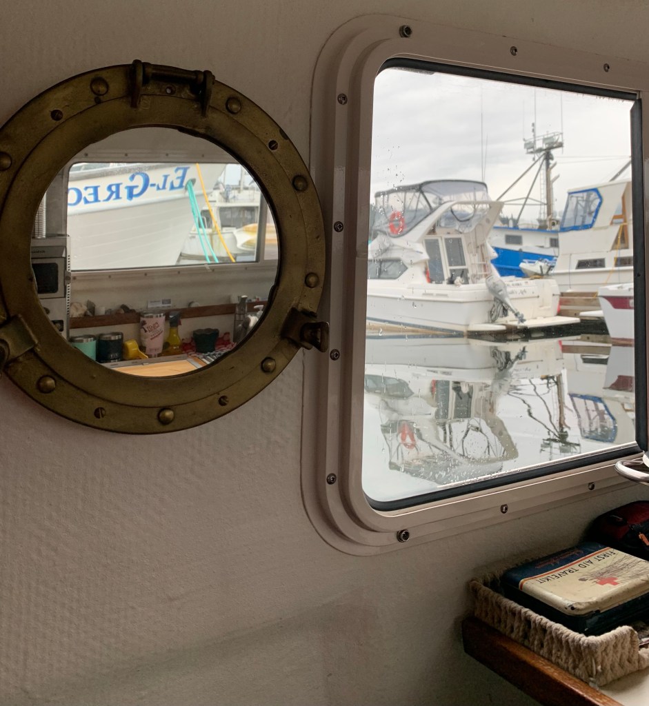
The sun is setting earlier now (8:30 pm), so we knew we’d be running out of daylight as we approached Ketchikan.  What concerned me more was the fog bank I could see farther down the narrows. I wasn’t comfortable speeding up as the light faded, since I wouldn’t be able to see or avoid logs in the water, so we pressed on in hopes we’d get to Bar Harbor before the fog. We didn’t. It was good and dark by the time we passed the airport and ferry terminals a couple miles from the marina, and the visibility dropped to less than ¼ mile after that. Thankfully, with good charts and a little familiarity from our time here two months ago, we navigated safely into the narrow south breakwall entrance at 9:00 pm. We snagged the same spot on Float 4 that we used in June and tied up for the night.

Kel’s Musings

Snow Passage (No whale photos, instead fishing boat and common murres filled my viewfinder) Photo Credit: Kel Rohlf

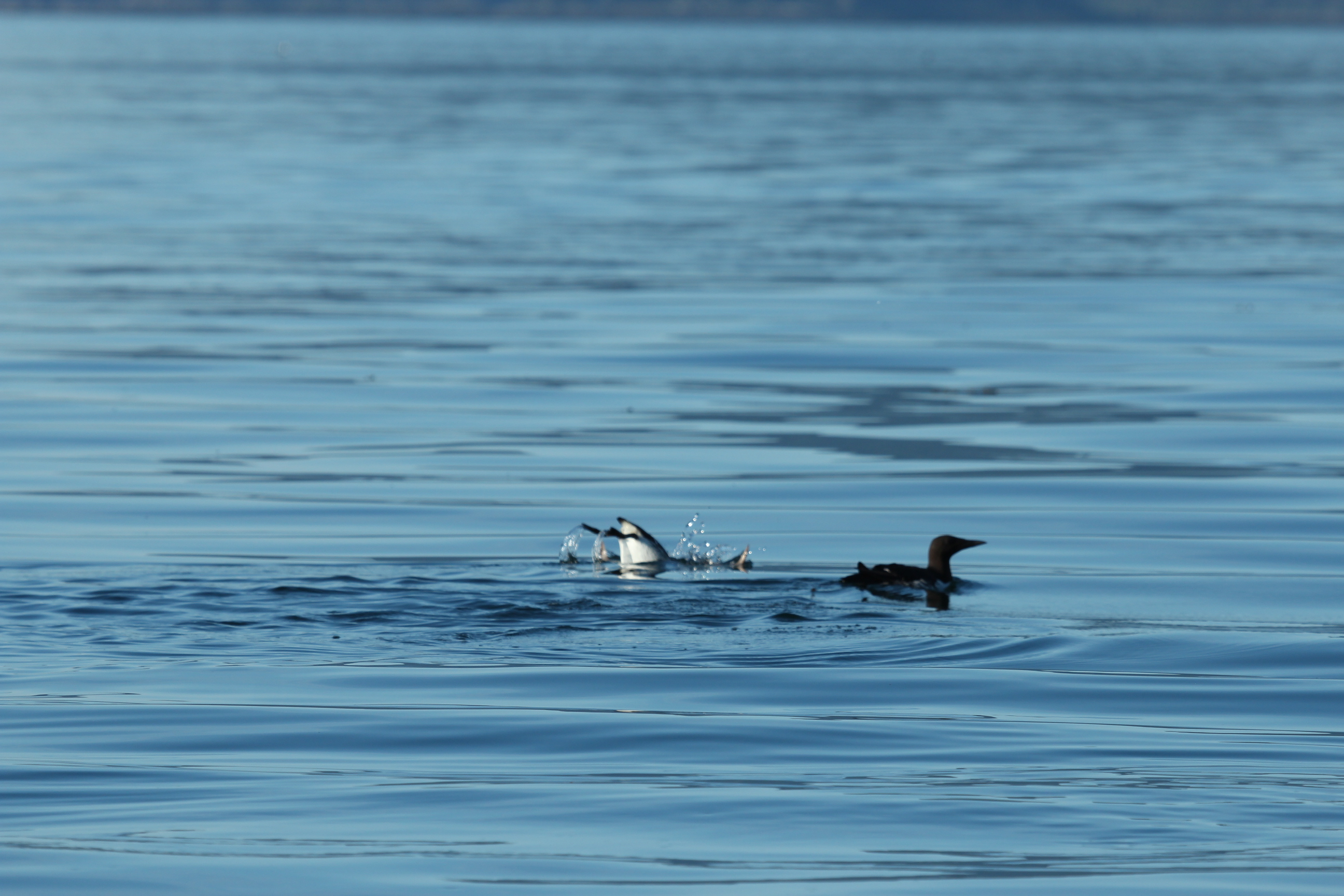
Being back in Ketchikan marks the next phase of our summer adventure. Two months ago, we were wide-eyed and everything was new and interesting. Working our way back to Ketchikan, Les chose unexplored vistas, and Rocky Pass was the highlight of our passage from Kake to Ketchikan. I marvel at the flexibility that we’ve honed as we go from place to place. A couple times we made some last minute decisions on where to stop each day. Thankfully, we were both in agreement. Our planned moorages included Point Baker and Thorne Bay. When we arrived at each place, it was apparent that these small communities we’re tucked in, almost as if it was off-season, but most likely locked down due to a rise in Covid cases. We chose the first night to go a little further and anchor at Salmon Bay. We woke to a beautiful sunny day and glided across the channel. We made our way to Snow Pass, whales spouting along the shore and evading my camera. I got some photos of common murres. After that some Dalls porpoises ran alongside the bow for awhile. We made it to Thorne Bay by early afternoon. As Les mentioned not much was happening there, and so we decided to head to Ketchikan.

common murre
more common murre
two common murres

One funny thing that happened in Thorne Bay. We were walking around town to see what was open, and two young boys were selling something from a cooler. I found out they were selling popsicles, which sounded great on the sunny, warm August afternoon. However, we were too late. They were finishing off the last two popsicles themselves, while they waited for their adult supervisor to pick them up. We gave them a donation anyways, and I got a popsicle at the grocery store.

Floating home in Thorne Bay

As we left Thorne Bay the winds picked up and opposed the tide making for a rollicking ride. I was feeling the sway in my stomach, and tried to ease it, but even lying down didn’t help. Finally, I offered to drive the boat, which usually helps. It gives me something else to focus on. I jokingly told Les that I handled the helm during the “most treacherous” part of the trip. He said he would call it uncomfortable, not treacherous. I conceded. My contribution to the navigation of this trip pales in comparison with his steady hand at the helm. I gained a greater appreciation for the amount of energy and concentration it takes to pass through the waters on “uncomfortable” days.

Sunset on Tongans Narrows nearing Ketchikan

Our return to Ketchikan via the Tongass Narrows to the marina was sporty. As Les said the darkness fell quickly and the fog engulfed us. This time familiarity was our friend. Having entered this way before, even though I was poking my head out the window to see how close we were to the rock breakwall, I felt comfortable with the turn Les making because it was familiar. However, we met a fishing boat coming out of the darkness as we entered. We saw each other in time to maneuver and avoid each other. It was a great relief to be back at the same slip we stayed at previously. We walked to McDonald’s for a late dinner, the trip across wasn’t conducive to cooking dinner on the boat.

While back in Ketchikan, I catch myself recalling our arrival. We went to Pilot House Coffee, and I remembered our first “date” there using the wifi. And I pointed out places we found during our first visit. “Remember how steep we thought the ramp was at low tide. (It’s still steep.) That’s were we bought my tall boots.” These little things I would mention, as Les and I walked into town the last couple times.

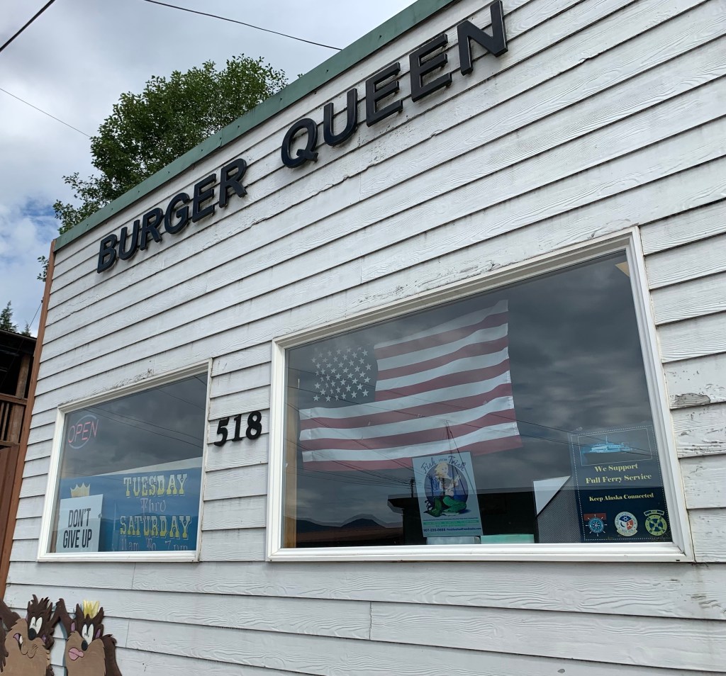
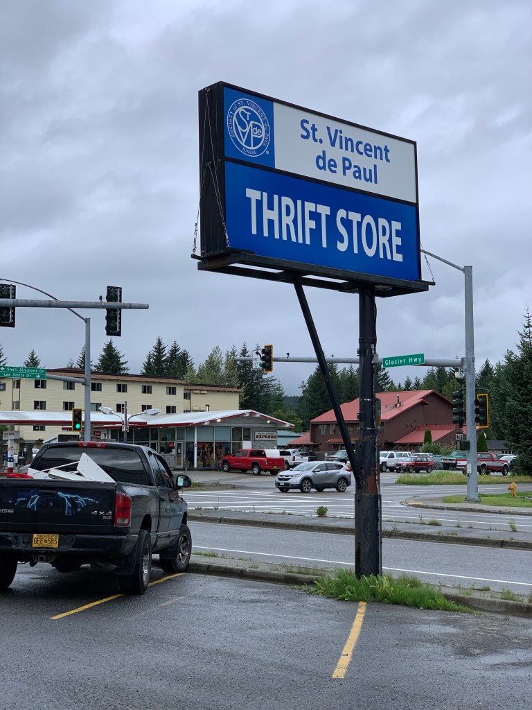
This time we ate lunch at Burger Queen because of its popularity. The food was okay. But we preferred the New York Cafe and 108 Taproom. We went back to Creek Street, so I could check out the yarn store. Very good selection, but I knew I could go to the Salvation Army and get a bunch of yarn for the price of one skein there. The attendant at Salvation Army is very generous. She only charged me $5.00 for an armful of yarn.

We found some art supplies at the Tongass Business Center, an office supply store extraordinaire! I splurged on a few goodies. And Les got a dry erase pen to write notes on the helm window. We stopped at a local haunt, and enjoyed the camaraderie of the locals. Very welcoming and friendly folks here in Ketchikan. We ate dinner on the boat.

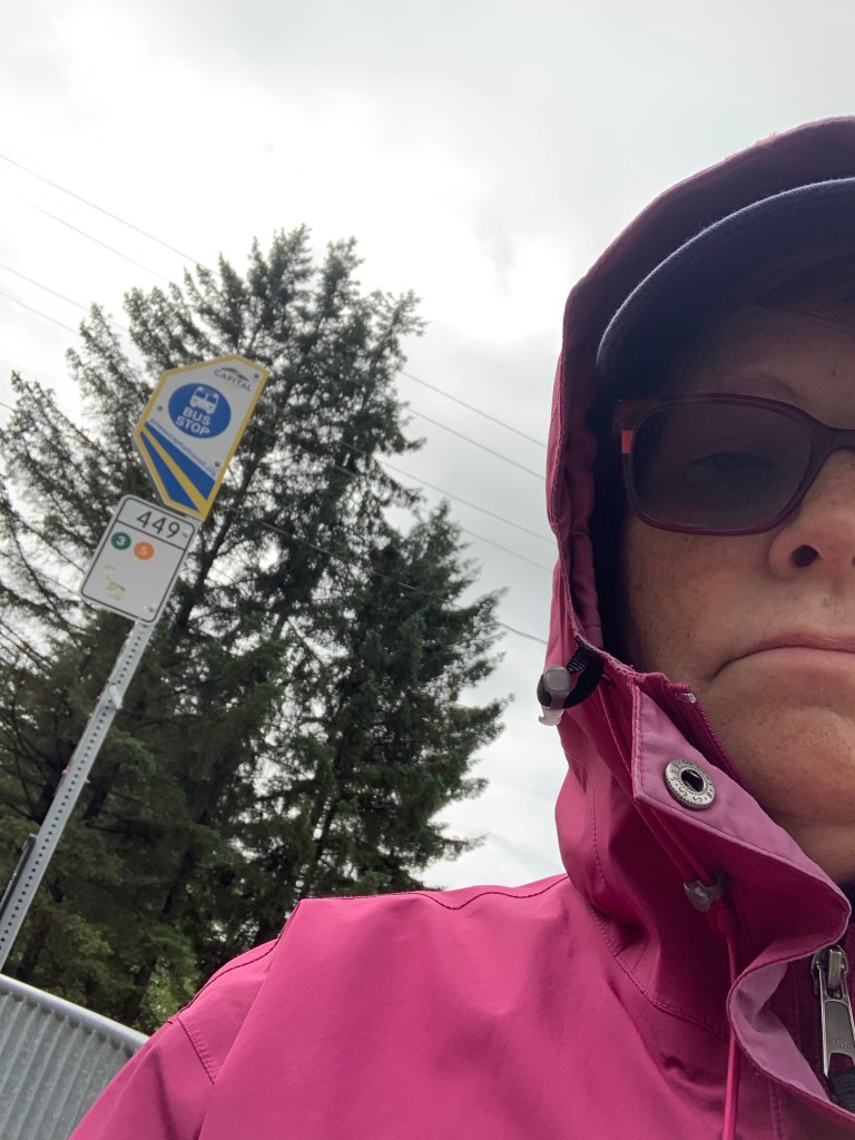
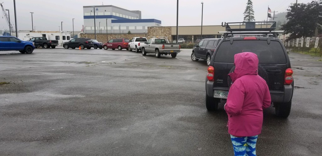
Our last day in Ketchikan was errand day, and the sunshine gave way to one of their chilly, rainy days. We bundled up to go get a Covid test, required to stop at ports and get off the boat in Canada. Les found a location a half mile from the marina to get free tests. It was in the parking lot of the Ferry terminal. We stood in line with the cars and a few other pedestrians. The test wasn’t as bad as I imagined it might be, up to now neither of us had needed a Covid test. The hardest part was waiting in the rain. While we waited, we met a couple who had sailed from Europe, and were spending part of their round the world trip here in Alaska. We exchanged contact info, and will most likely cross paths again as we all tested negative, and are able to start our journey through Canadian waters back to the Seattle, Washington area.

Standing in drive thru line for Covid test
Covid test center
Waiting in the rain

After our exciting morning, we spent the rest of the day doing laundry, getting groceries and filling the water tank on the boat. Les spent most of the day following the weather reports, as we have the long Dixon Entrance crossing to accomplish to get to Prince Rupert, our port of entry into Canada. It’s roughly 80 nautical miles. We hope to take two days, as there is a protected bay part way. The weather looks “spicy” and “uncomfortable,” but not treacherous. We won’t leave Ketchikan if it’s that “snotty.” The adventure continues, even as we say our farewells to Alaska.

“God, investigate my life; get all the facts firsthand. I’m an open book to you; even from a distance, you know what I’m thinking. You know when I leave and when I get back; I’m never out of your sight. You know everything I’m going to say before I start the first sentence. I look behind me and you’re there, then up ahead and you’re there, too— your reassuring presence, coming and going. This is too much, too wonderful— I can’t take it all in!” (Psalm 139:1-6 The Message)

Auke Bay to Kake (August 8-21)

Bear at Warm Springs Bay (Photo Credit: Kel Rohlf)

Words and Photos by Les and Kel Rohlf as indicated

Kel’s Musings

Les keeps notes as we go, and I write my musings after reading his notes. Today’s notes are a great synopsis and good picture of life on the Intuition over the past couple weeks. I will keep my musings short today, as we are leaving soon to pass through the Rocky Pass in Keku Strait which connects Frederick Sound to Sumner Sound. We have internet in Kake, so we wanted to get a post out to catch everyone up on our adventure and share bear photos! Yes, we’ve seen bears in a couple of the bays, plus the one I saw in downtown Juneau during our Auke Bay respite.

When we left Auke Bay, I felt a sadness of leaving that area, as well as knowing that we would be saying good-bye to Southeast Alaska in a week or so. I was also wondering if the return trip would be as interesting as the trip the past couple months. As I grappled with these emotions, I was surprised by unexpected joys. The route Les planned for our return to Ketchikan covers mostly unexplored destinations, which will be some of the most memorable thus far.

Familiarity breeds complacency. My awe of the majestic mountains had waned. My hope of seeing something new and different was low. But then little by little, the landscape, the clouds and the wildlife sightings quickly renewed my reverence for this place.

On our first day out, we saw dolphins and a sea otter. Even though the waters churned up, I was able to stave off any sea nausea. On the second day, we saw a whale spouting. That evening, I was doing some tidying up, and when I looked at the shore a bear was walking along, and at the same time a sea lion swam nearby. I truly got choked up, because of the honor of seeing these creatures in their natural habitat. After watching the bear for awhile, I did get my camera out to catch him chewing on grass. On the subsequent days of cruising and anchoring out, we witnessed two bears sauntering along the banks of the bay, saw eagles and seagulls swooping to catch fish, and a sea lion entertained us during dinner.

Bear looking for salmon in Warm Springs Bay (Photo Credit: Kel Rohlf)

When we left Red Bluff bay, which was spectacular with mountain views and waterfalls, we watched the sun light up the shore interspersed with a rainbow across the mountains, during a light rain. Words cannot capture the feeling of being here, nor could we ever take enough photos, but we’re doing our best to treasure and give thanks for these memorable moments. My hope is that when we’re having rainy days or frustrating days, here or back home that these moments will cheer our hearts.

Red Bluff Bay entrance

Well, that’s it for now. I have been appointed the lookout for Rocky Pass. We have to get there at a favorable tide, so we need to post this, and leave our pleasant moorage here at Kake. Until next time, may the blessing of a smile be yours.

Kel exploring Red Bluff Bay (Photo Credit: Les Rohlf)

Les’ Notes

August 8-17

Auke Bay

We relaxed, read, and gathered a few items to take home during our 10 days in Juneau.  There was a day or two when the weather was OK, but few days without fairly high winds in Chatham Strait and Lynn Canal. It was certainly easier to deal with the sloppy weather here than anchored in a bay 100 miles south.

The big event while we were here was the Golden North Salmon Derby the weekend of 8/13-8/15. One of the reasons we couldn’t get our motor serviced earlier was that so many people had last-minute service needs prior to the derby. The salmon caught are sold with profits going toward scholarship funds for local students. There was a constant line of boats coming in and going out from the double ramp at Auke Bay all weekend.

We took the bus downtown a couple times for shopping and had lunch at the Alaska Fish and Chips and Crepe Escape – both were very good. A couple other places we ate that we would recommend: Donna’s Restaurant near Nugget Mall and the Village Restaurant just north of the airport served very good diner/comfort food. We had very good breakfasts at both. Our last night there we had date night at the Laundromat. Upstairs in the same building is Squirez Bar, so we checked it out during the wash cycle. It has a great view looking out onto Auke Bay and includes a food vendor with excellent sandwiches and burgers. I might have volunteered to do the laundry if I had known about it earlier.

One of our neighbors in Auke Bay (Kellie on Salty Dawg) generously gave us some recently-caught salmon. We grilled it on Monday – it was excellent.

(Photo Credit: Les Rohlf)

Kel got the best bear photos so far when she spotted a black bear at a dumpster in downtown Juneau.

Thursday, August 18, 2021

Auke Bay to Funter Bay

Miles: 27

Hours: 4.6

We passed the Statter Harbor channel markers into Auke Bay at 6:00 am. The breeze out of the east pushed us along until we turned north to pass behind Shelter Island. We turned south around Point Retreat and into the swell of the southern Lynn Canal. Wave heights were forecast to be 3 feet today in southern Lynn Canal and northern Chatham Strait, and my planned destination for today was Pavlov Harbor in Freshwater Bay.

Initially the water conditions were good, with smooth 1-2 foot swells that we could glide over. The sea and weather conditions were kind of hypnotizing with the gray water blending into the milky, indistinct horizon. The cloud level was very low this morning, with occasional fog banks. As we headed south, a float plane passed us going the opposite direction at only 200-300 feet in order to stay below the clouds.

The waves became increasingly big, bossy, and steep as we continued, causing the boat to drop off the edge of larger waves and pound, even at our torrid 6 mph speed. Not wanting to continue pushing through for another 30 miles, especially with the tide about to turn against the wind, we opted to pull into Funter Bay. There’s a state float along the south shore, so we tied up to the back side of it about 10:30 am. There’s still a pretty stiff breeze out of the east blowing through the bay, but we’re comfortable at the float.

Abandoned Building in Funter Bay (Photo Credit: Les Rohlf)

We rested and read the rest of the day. There’s decent AT&T cell reception here. Rain showers and low ceilings continued throughout the day. By the end of the evening, four other fishing boats joined us on the float.

Thursday, August 19

Funter Bay to Warm Springs Bay

Miles: 87

Hours: 12.1

We had very calm waters all day.  We ran at slow cruise except for about 90 minutes when fighting the worst of the incoming tide. After looking ahead at the weather forecast, we’ve decided to prioritize Warm Springs Bay and Red Bluff Bay in our itinerary. There’s a couple weeks’ worth of bays to explore off Chatham Strait, but we’re now starting to realize our remaining time is limited. The goal (not schedule) is to get to Ketchikan by middle of next week and look to continue south into Canada at the end of that week.

the warm springs (Photo Credit: Les Rohlf)

By the time we got to Warm Springs Bay at 4:30 pm, there were no spots available on the dock. Warm Springs Bay includes hot springs (duh?) above a group of homes situated to the east of a very large, picturesque waterfall. A trail leads from the public dock up to the springs and Baranof Lake, whose outflow serves as the source for the waterfall. There’s also a public bath house with three separate tubs fed by the springs, which overlooks the bay and waterfall.

We first tried to anchor in Schooner Cove, but didn’t feel there was enough swing room for the amount of rode I’d need. We moved over to the head of the southwest arm and anchored against the head of the bay. As the light was getting dim, a brown bear appeared at the creek feeding into the bay. After wandering back and forth along the edge, he got excited by the jumping salmon and perched on a rock at the edge of the water. He made two dives into the water after fish, but came up empty.

I ended up turning off the anchor alarm because the GPS kept losing connection and triggering the alarm. Fortunately, we had a very calm night in a well-protected anchorage.

Friday, August 20, 2021

Warm Springs Bay to Red Bluff Bay

Miles: 24

Hours: 4.1

We awoke to the sound of splashing around the boat. A sea lion was fishing in the cove. It was amazing to watch it catch a fish and spend the next few minutes thrashing its head back and forth while holding the fish.  I assume this behavior helps to rip off bit-size pieces – guess I need to look that up.

We pulled the dinghy down, gathered our stuff, and headed over to the dock to visit the hot springs.  We tied up behind the float plane dock and walked up to the path toward Baranof Lake and the springs. We missed the turnoff to the springs and arrived at the lake. After returning most of the way, we met a lady going to the springs who showed us the path to the springs. When passing it the first time, we assumed it was just a path to the top of the waterfall, as it was much rougher and more difficult. It is, but that’s where the springs are located. The two pools are super hot and really hot, so we soaked our feet and legs for a few minutes and headed back to the bath house.

The bath house was nice, because you can regulate the temperature with some cold water. We took a luxuriating soak and headed back to the boat. We set up a bridle on the dinghy so that we could tow it the 23 miles to Red Bluff Bay, then had lunch before leaving Warm Springs Bay at 1:00 pm.

Bathhouse in the background with green curtains (Photo Credit: Les Rohlf)

We saw a whale feeding near Point Gardner, then some Dalls Porpoises shortly after. The ride to Red Bluff Bay was comfortable, with only some long low swells. We arrived at the entrance shortly before 4:00pm. The rust-colored bluff that stands as a sentinel over the entrance to Red Bluff Bay is unique among the landforms I’ve seen on our trip. Not too many superlatives are unwarranted for Red Bluff Bay. We cruised around the striking islands that serve as a barrier between Chatham Strait and the bay, looked at the defunct cannery ruins inside the first bay, and continued the 4 miles to the head of the bay.

Two other cruisers were already anchored behind the spit at the far end of the bay, but we found a nice level section with about 35 feet of water just short of that point. We’re able to look across at the wide meadow and creek that exits into the bay. We saw a couple bears patrolling the shore along the meadow. It’s like a live version of Animal Kingdom from our dinette tonight while a smaller sea lion catches fish from around our boat.

I grilled tri-tip and potatoes while Kel explored the bay and the large waterfall across from us in the dinghy. Just before dark, a sailboat entered and anchored between us that our two neighbors. Shortly thereafter, Serengeti, a super-yacht, pulled into the bay and anchored between us and the waterfall.

Two bears at Red Bluff Bay (Photo Credit: Kel Rohlf)

Saturday, August 21, 2021

Red Bluff Bay to Kake

Miles: 38

Hours: 4.0

We left the dinghy down last night so that we could use it this morning before we left Red Bluff Bay. When we awoke, we saw two bears walking along the north shore at low tide. They eventually made it all the way around to the southeast shore near where we were anchored. After breakfast, we hopped into the tender and motored to the other side of the bay where the creek exits and watched the bears as they returned to the meadow and up the creek.

We got the dinghy back onto the roof with minimal drama and started out from the anchorage at 9:00am. While less dreary this morning, we did get a short rain shower as we prepared to leave. We enjoyed the scenery during our slow cruise out of the bay and pointed ourselves toward Frederick Sound.  We ran on plane for most of the way around the north side of Kuiu Island to Kake, with smooth water almost the entire way.

I had called Kake Tribal Fuel yesterday to check on the logistics for getting gas. Fuel at Kake is delivered via a truck on the drive-down dock, since their gas dock was destroyed in a storm five years ago. Since they close at 2:00pm on Saturdays, he asked me to arrive as close to noon as possible. I called them 30 minutes out, and arrived at 12:15pm. This was also the most expensive gas of the trip, even more so than Shearwater. I didn’t fill up as I expected it to be more expensive, but still should have more than plenty for trip to Ketchikan over the next few days.

Fuel delivered by truck in Kake (Photo Credit: Les Rohlf)

After getting gas, we continued south from Kake to their harbor a couple miles south of the main village. We’re tied off to a long dock identified for transients – the harbor is nice, protected, and about the size of the one in Tenakee Springs. Kake has apparently locked themselves down, with tight restrictions on both residents and potential visitors. Everyone we’ve met has been friendly and helpful, but it’s clear from all the posted notices that leadership is trying to stem any new introduction of the virus into smaller, more isolated communities like Kake. We walked slightly less than a mile to the SOS Hardware and Market to gather a few items. The store had a good selection of food items and would be a realistic resupply location if needed.

God, come back!
    Smile your blessing smile:
    That will be our salvation.
(Psalm 80:3 The Message)

Living on Our Intuition

View from our dining table

Words and Photos by Kel Rohlf

As I’ve alluded to in past posts, my dream has been to live on our boat. It was autumn when we bought the boat, and the first thing I told Les was that I wanted to spend Christmas Eve on the boat. We made reservations at the Alton marina near our home. I packed food, warm clothes, a little Christmas tree and stockings and brought gifts. Our sons met us Christmas morning.

We were new boaters. We knew we’d have shore power, where we “plug” the boat into a receptacle on the dock. Neither one of us thought to bring our little electric heater. We were quite cold our first night on the Intuition. I slept with my warm hat hunkered down in the sleeping bag.

We planned to bring the boat home that afternoon, but soon realized that the ramp where we put in was below a level for taking boat back onto the trailer. That happens at Alton when the lock and dam lets water out. We didn’t know, we were first time boaters. Thankfully, the marina let us keep our boat there free of charge. A week later we decided that we could get it out at a ramp north twenty miles. One son pushed ice chunks out of the path out the boat while Les drove, and the other son and I drove the truck and trailer to the ramp. A great first memory of our Intuition.

Since then we’ve “lived” on our boat while cruising rivers, canals, lakes and inter coastal waterways. While living on our boat this summer, I realized there are three ways that we live: cruising, anchoring and hanging out at marinas.

While cruising Les does the majority of navigating and driving. I take over the helm from time to time to give Les a break or to give me a different perspective. I like to be “doing” something. I can read, write in my journal, take photos, knit, nap or cook meals while we cruise. And often Les and I’ll talk about life or what’s next when we arrive at our destination.

We like a good mix between anchoring and staying at marinas on a long trip like this. On some trips, we primarily stay at a marina like when we stayed in Florida at Marineland marina. One of my favorites because I could walk across the street to the beach, while Les worked from the boat. On weekends we often only anchor out when we cruise up to our favorite diner in Hardin, Illinois. And occasionally we stay at Alton marina.

There’s only a few differences between anchoring or mooring at a marina, when it comes to living aboard. The obvious one being that at marinas we have access to the amenities on shore, like showers, laundry, groceries and shore power. While at anchor we have a solar battery to charge electronics and a house battery to run lights, the refrigerator and water pump for the sink. All our radios and gadgets are powered by the boat batteries. The boat batteries (two) charge while we motor around or via a portable generator if we need it. Les would like to use solar power to recharge those batteries, as technology becomes more affordable and efficient.

Solar Input/Output box built by Les (the battery is stowed in the hatch under the dinette and is wired to a solar panel that is attached to the roof of the canvas covering on the back of the boat.)

Whether we’re anchored out or at the marina one of my favorite occupations is planning and cooking our meals. Storage on the boat is minimal, but I have created a galley and system for storing food, dishes etc that works. Sometimes Les will offer to cook or deal with the dishes, but I often have to intervene because I know where everything is stowed.

Our boat is pretty easy to keep clean. Making the bed is a chore since you have to climb in the berth to tuck the sheets, but on this trip I’ve become a pro at pulling everything out, since water from condensation has been accumulating under the hypervent padding. The bed is three layers: the hypervent, cushions and memory foam. I pull everything out about once a week, dry the fiberglass platform that all the layers rest upon, then put it all back.

Cleaning day
Our tiny living space

Living on a boat is work. Living on our boat is a great pleasure, as we’ve made it our own and it’s just right for the two of us. We give each other space when we need it. One of us will sit inside, while the other sits on the “back porch.” And when we’re in port, we can go off exploring by ourselves, if we so choose.

Taking the bus to downtown Juneau for a solo adventure

Living on our boat may be seen as romantic, but mostly it’s not that much different than living our everyday life. Except, of course, the views and the water and the places we get to see. Otherwise it’s eat, sleep, shower and embrace each new day.

Give your entire attention to what God is doing right now, and don’t get worked up about what may or may not happen tomorrow. God will help you deal with whatever hard things come up when the time comes. (Matthew 6:34 The Message)

Route Planning

Photo Credit: Kel Rohlf

A note from Kel regarding route planning:

I truly appreciate and enjoy the fruits of Les’ planning. My criteria for the route amounts to calm seas and a thrift store in every port.

Words and Photos by Les Rohlf

Southeast Alaska is so large that even our two months’ time here allows only an overview. How then to choose the places we’veincluded in this year’s trip?

My approach to creating a list of desired destinations involved reading (in some cases over several years) as many blogs and trip logs as I could find from those who had previously traveled here. A number of C-Dory owners have toured southeast Alaska and memorialized their experiences on C-brats.com. These were invaluable, as well as blogs and webinars from Slowboat.com, for example, who have led flotillas of boats to Alaska for several years. Descriptions of the various places to anchor, sites to explore along the way, and available facilities helped us narrow the choices of stops. Printed references included Exploring Southeast Alaska by Don Douglass and Reanne Hemingway-Douglass. People have also reached out to us personally with suggested destinations based on their previous trips.

We’ve been fortunate to travel across a wide area of Southeast Alaska, to include the northern-most destinations within Glacier Bay and the Lynn Canal, along with the towns of Skagway and Haines. For at least our first trip here, I’ve tried to stay within the shelter of the Inside Passage straits and passages. Given more time to allow for weather delays, I would love to explore some of the destinations on the west side of Chichagof and Baranof Islands, as well as the more exposed areas on the west side of Kuiu Island.

I’ve been looking ahead at the next couple weeks as we begin the return journey southward toward Ketchikan. We chose to go directly to Auke Bay after departing Sitka, in order to avoid getting caught out in the messy weather we’ve experienced for most of last week. Because of that choice, we missed exploring several beautiful bays that line the east side of Baranof Island, so our route south will include that section.

The dark blue line on the image below shows the overall view for the next week with approximate route planned from Auke Bay at the north end to Keku Strait at the south. The possible stops at Ell Cove, Takatz Bay, Warm Springs Bay, Red Bluff Bay, and Gut Bay are located south of Peril Strait on the west side of Chatham Strait.  After leaving Chatham Strait, we’ll travel west in Frederick Sound to Kake for gas before heading south through Keku Strait. Keku Strait, which separates Kuiu and Kupreanof Islands and whose middle section includes the remote and challenging Rocky Pass, leads south into Sumner Strait, from which we’ll transition to Clarence Strait and eventually Ketchikan. 

Each day’s route requires a certain level of detailed planning. I’ll use the Auke Bay to Funter Bay leg as an example. This section is planned for Tuesday, 8/17 after servicing of our main motor has completed. This is a relatively short leg of 26 miles, since we’ll be starting from Auke Bay in the afternoon.


I start by adding waypoints along my planned route on the chartplotter as shown in the image below. The chartplotter addsfunctionality to setup a Route by linking these waypoints. The straight, black line connecting the waypoints represents the route. The less-straight, green line that coincides with this route is the actual track from our trip last Saturday to Auke Bay, so we’ll be traveling the reverse of our route from last week for the first 90 miles.


Once I have the route established, I zoom in on each leg to look for obstructions or details that warrant changes to the route. While I don’t blindly follow the route when navigating, I don’t want a route that if followed would run us into an island, rock, or reef. Once underway, I also use a higher resolution view that makes identifying and avoiding such obstacles easier.

When planning each day’s route, we also consider the effects of tide exchanges. This is more important when transiting potentially dangerous passes like Seymour Narrows, but also establishes expectations for each days’ routes. The next image shows the tide forecast for Funter Bay on 8/17, our planned arrival date. The tide forecast for Auke Bay, our starting point, is fairly similar. Assuming we depart Auke Bay after high tide at 9:45 am, we can expect some benefit from the ebb tide until low tide at 3:10 pm. 


In some cases there are good reasons for going “against” the tide. With south winds expected for Chatham Strait on 8/17, a south wind blowing in the opposite direction of an outgoing or ebb tide can create steep and uncomfortable waves. Wind moving in the same direction as the tidal flow tends to lessen the effect of the wind on wave height.

In addition to what our chartplotter shows, tide forecasts are available from the Ports and Passes book which we carry and from a smartphone app I use. Best practices involve verifying that forecasts are in agreement for similar locations, rather than consulting only one source. Tidal forecasts are just that, and may vary with wind and other weather conditions. Nevertheless, having an idea of what to expect (and when) from tides and their resulting currents is a critical part of route planning in the Northwest U.S. and Canada.

Another important aspect of daily planning includes places tobail-out should weather conditions deteriorate or differ from forecasted. This works both ways, as there have been days when we continued beyond a planned stop to take advantage of good weather conditions.

Next up Kel will muse about the three environments of living on the boat: 1) Cruising Days 2) Anchorages and 3) Marinas.

We humans keep brainstorming options and plans, but God’s purpose prevails. (Proverbs 19:21)

Anchoring

View of anchor from center front window hatch (Ford’s Terror after passing through the narrows) Photo credit: Kel Rohlf

Words and photos by Les Rohlf

Anchoring seems to be part science and part art. In an effort to more precisely place the anchor for specific conditions, I’ve been using the following technique, which takes advantage of the sonar, chartplotter track, and windlass. This process has crystalized for me during my time in Alaska for a few reasons: previously we anchored much of the time in a river where current will hold you in place; we didn’t have to allow a factor for tides; and I now have a windlass that allows me to more precisely drop the anchor based on what I’m seeing on the chartplotter.

This picture shows an image of my chartplotter after we’ve been at anchor for a while, but the recorded track helps illustrate the process. The image was taken at our anchorage at Cannery Cove in Pybus Bay. Once in the area I want to anchor, I zoom the chart image to a scale that shows 200 feet in the lower right. I’ll use this to help plot my maximum swing radius. One assumption is that I’ll need 100-150′ of rode to achieve desired scope. The circle described below may be larger or smaller if the needed rode length will be different.

We entered this corner of the cove from the north. We came in near high tide, and I wanted us in at least 20 feet of depth throughout our swing range. Low tide was forecast to be 10 feet less than high tide. The track coming in from the north shows me following (as much as possible) a 30-foot contour.

At anchor in Pybus Cove (Photo Credit: Kel Rohlf)

The lowest point of the track was as close as I wanted to be to shore (not always accurately shown on charts), so I started a circle that would approximate my maximum swing radius (about 150’ radius or 300’ across). We monitor the sonar throughout the circle for any surprises – in this case it indicated progressively deeper water away from shore without being excessively steep. To be even more diligent, many people recommend several circuits of the anchorage to be certain.

Once the circle is complete and I’ve seen no other issues, I turn to the middle of the circle and prepare to drop the anchor. In my case the GPS track is on the chartplotter (near the front of the boat), while the transducer is showing depth and the bottom from the stern. Once I reach the center and am ready to deploy the anchor, I back the boat up slightly to ensure the anchor is over the spot I’ve verified on the sonar display. This is also the point where I set the anchor alarm (something I typically don’t remember). Once the anchor hits the bottom, I want to smoothly idle in reverse as I pay out the anchor rode; this ensures the rode extends in a line and is not just a pile on the bottom. Once I’ve extended the planned amount of rode, I allow it to tighten up. This ensures the rode is extended in a continuous line and the anchor is oriented in the direction I want before attempting to set the anchor.

The track in the photo above shows the turn to the center, followed by backing away on a slightly different line. Once the anchor was set and everything tied off, the wind held to boat toward the west-southwest side of the circle.

The initial circle of the anchorage and its track give me a level of confidence that my swing radius will keep me in deep enough water and provides an objective indication if the anchor begins to drag.

This process becomes more critical in a place like Ford’s Terror where the space to anchor is more limited. In the West Arm of Ford’s Terror, the more popular anchorage there, there’s a fairly short distance between the very shallow (or dry at low tide) creek outlet and 80+ foot depths where anchoring becomesdifficult (or requires a very long rode). The image below shows my track in Ford’s Terror. The top oval section of the track is where I found water less than 20 feet deep (on a 15-foot hightide), which identified an area into which I did not want to swing while anchored. Once anchored I could monitor the extremes of the boat’s swing to ensure the anchor placement did not allow the boat to float into an area that would later be too shallow.


To complete the narrative on our process for anchoring, once ready to set the anchor, I go up to the bow, pass the rode through one of the chocks, and secure the rode to the cleat on the bow. Kel then puts the boat into reverse to set the anchor. Once set, I have a separate line around a snubber that is attached to the boat’s bow eye (on the bow at the water level). I use a rolling hitch to connect this to the anchor rode. The anchor rode is still connected to the bow cleat as a fail-safe, but the force is applied to the center bow of the boat and includes shock absorption of the snubber. This system doesn’t keep the boat from sailing at anchor, but keeps the boat from abruptly jerking to a stop at the end of each swing.

This hope we have as an anchor of the soul, a hope both sure and reliable … (Hebrews 6:19 NASB)

In the next post, Les shares his planning strategies and Kel muses about living on the Intution.